Black River, Ontario
For other places with the same name, see Black River.
| Black River | |
|---|---|
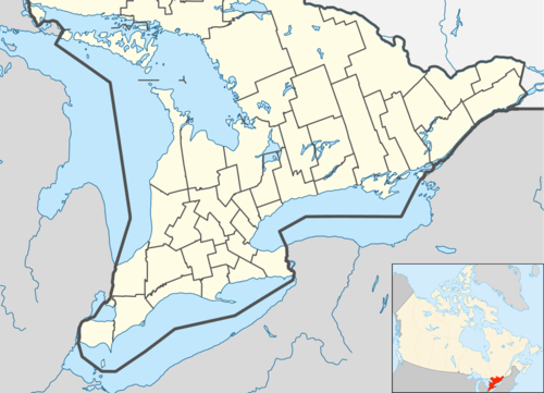 Black River Location in southern Ontario | |
| Coordinates: 45°04′43″N 74°52′16″W / 45.07861°N 74.87111°WCoordinates: 45°04′43″N 74°52′16″W / 45.07861°N 74.87111°W[1] | |
| Country | Canada |
| Province | Ontario |
| County | United Counties of Stormont, Dundas and Glengarry |
| Municipality | South Stormont |
| Elevation[2] | 77 m (253 ft) |
| Time zone | Eastern Time Zone (UTC-5) |
| • Summer (DST) | Eastern Time Zone (UTC-4) |
| Postal Code FSA | K0C |
| Area code(s) | 613, 343 |
Black River is an unincorporated Dispersed Rural Community in the municipality of South Stormont, United Counties of Stormont, Dundas and Glengarry in eastern Ontario, Canada.[1] It is located about 2 kilometres (1.2 mi) north of Ontario Highway 401 and 5 kilometres (3.1 mi) northeast of the community of Long Sault, and is on the Raisin River.
See also
- Black River-Matheson, Ontario, a township municipality in Cochrane District
References
- 1 2 "Black River". Geographical Names Data Base. Natural Resources Canada. Retrieved 2014-06-19.
- ↑ Taken from Google Earth at geographic coordinates, accessed 2014-06-19.
Other map sources:
- Map 11 (PDF) (Map). 1 : 700,000. Official road map of Ontario. Ministry of Transportation of Ontario. 2014. Retrieved 2014-06-19.
- Restructured municipalities - Ontario map #5 (Map). Restructuring Maps of Ontario. Ontario Ministry of Municipal Affairs and Housing. 2006. Retrieved 2014-06-19.
- "Topographic Map sheet 31G2". Atlas of Canada. Natural Resources Canada. 2010-02-04. Retrieved 2014-06-19.
This article is issued from Wikipedia - version of the 5/20/2016. The text is available under the Creative Commons Attribution/Share Alike but additional terms may apply for the media files.