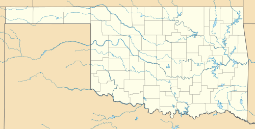
Blackjack Mountain (Oklahoma)
| Blackjack Mountain | |
|---|---|
 Blackjack Mountain | |
| Highest point | |
| Elevation | 1,250 ft (380 m) [1] |
| Coordinates | 34°23′23″N 95°15′01″W / 34.3898238°N 95.2502401°WCoordinates: 34°23′23″N 95°15′01″W / 34.3898238°N 95.2502401°W [2] |
| Geography | |
| Location | Pushmataha County, Oklahoma, U.S. |
| Parent range | Ouachita Mountains |
| Topo map | USGS Wildhorse Mountain, Kosoma, Finley, Cloudy and Nashoba |
Blackjack Mountain is 17 miles (27 km) long mountain ridge trending from northeast to southwest in Pushmataha County, Oklahoma.
The highest peak has an elevation of 1,250 feet (380 m). The town of Rattan is south of Blackjack.
References
- ↑ "Blackjack Mountain". ListsOfJohn.com. Retrieved 2011-08-08.
- ↑ "Blackjack Mountain". Geographic Names Information System. United States Geological Survey. Retrieved 2011-08-08.
This article is issued from Wikipedia - version of the 12/26/2015. The text is available under the Creative Commons Attribution/Share Alike but additional terms may apply for the media files.