Bloodvein First Nation
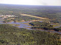
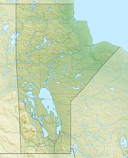
The Bloodvein First Nation is located on the east side of Lake Winnipeg, along the Bloodvein River in Manitoba, Canada.
History
This area is a part of Treaty 5, and has long been inhabited by native peoples. The name “Bloodvein” was used in an 1818-19 Hudson's Bay Company journal. The name originates from a major battle between the tribe inhabiting the mouth of the river and one of the neighboring tribes, where blood flowed into the river. The river was originally called the "Blood River" but was changed to "Bloodvein" by the HBC.
During the 18th century, the Bloodvein River was used by Ojibwa peoples as a trapping area for the fur trade, and it was a fur transport route. The community of Bloodvein, near the river’s mouth, is still inhabited by descendants of the Saulteaux-Ojibwa people, continuing the traditional native life of hunting, trapping, fishing and wild rice harvesting.
The Bloodvein River is located in one of the largest remaining intact boreal forest regions of the world. The Bloodvein River became Manitoba's first Canadian Heritage River in 1987 and much of the river is within Atikaki Provincial Park.[1]
The river’s historic features are the undisturbed archaeological sites which provide evidence of prehistoric, hunter-gatherer peoples in the area for thousands of years. There are pictographs (native rock paintings of red ochre) dating back to around 900 to 1,200 AD.[1]
There are many caribou, bears, wolves, bald eagles, lynx, owls, and various species of fish in the area. [1] The river and surroundings is the traditional land use area for the Ojibwa people.
The area is served by Bloodvein River Airport.
Demographics
As of March 2013, the First Nation had a total registered population of 1673 with 1042 members living on-reserve and 631 living off-reserve. .[2] The primary language spoken is Saulteaux.[3]
The First Nation has reserved itself the Bloodvein 12 an area of 3,885 acres.[3] Bloodvein First Nation is a member of the Southeast Resource Development Council.[2] and is governed by a Chief and four councilors.
During 2009 work started on upgrading the existing Rice River Road to Bloodvein and further extending it to Berens River.[4]
See also
References
- 1 2 3 "Atikaki Provincial Park & Bloodvein Canadian Heritage River" (PDF). Retrieved 2013-04-04.
- 1 2 "AANDC (Bloodvein)". Archived from the original on 2013-11-21. Retrieved 2013-04-04.
- 1 2 "Bloodvein". Retrieved 2013-04-04.
- ↑ http://www.eastsideroadauthority.mb.ca/pdf/eis_november4-09.pdf Retrieved 2010-06-19
External links
Coordinates: 51°46′37″N 96°41′42″W / 51.77694°N 96.69500°W