Blow-Me-Down Covered Bridge
|
Blow-Me-Down Covered Bridge | |
 | |
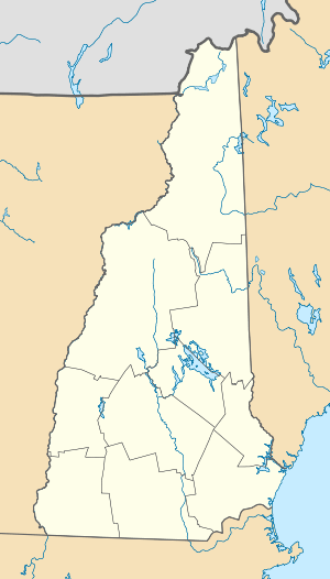  | |
| Nearest city | Plainfield, New Hampshire |
|---|---|
| Coordinates | 43°31′2″N 72°22′28″W / 43.51722°N 72.37444°WCoordinates: 43°31′2″N 72°22′28″W / 43.51722°N 72.37444°W |
| Area | 1 acre (0.40 ha) |
| Built | 1877 |
| Architectural style | Kingpost Truss |
| NRHP Reference # | 78000220[1] |
| Added to NRHP | May 19, 1978 |
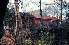
The Blow-Me-Down Covered Bridge is a historic wooden covered bridge carrying Lang Road over Blow-me-down Brook in the town of Cornish, near its northern border with Plainfield, New Hampshire. It is a single-span multiple Kingpost truss span that spans 85 feet (26 m) and has a roadway 14 feet (4.3 m) wide. It rests on natural granite ledges which have been levelled with dry-laid stone. The bridge was built in 1877 by James F. Tasker for $528.[2] The bridge was restored in 1980.
The bridge was listed on the National Register of Historic Places in 1978.[1]
See also
- List of New Hampshire covered bridges
- List of bridges on the National Register of Historic Places in New Hampshire
- National Register of Historic Places listings in Sullivan County, New Hampshire
References
- 1 2 National Park Service (2009-03-13). "National Register Information System". National Register of Historic Places. National Park Service.
- ↑ "NRHP nomination for Blow-Me-Down Covered Bridge" (PDF). National Park Service. Retrieved 2014-06-06.
External links
- Blow-Me-Down Bridge, New Hampshire Division of Historical Resources (dated info)
| Topics |  | |
|---|---|---|
| Lists by county | ||
| Other lists | ||
| ||
This article is issued from Wikipedia - version of the 12/2/2016. The text is available under the Creative Commons Attribution/Share Alike but additional terms may apply for the media files.