Bogen, Evenes
| Bogen Ránda | |
|---|---|
| Village | |
|
View of the village (looking south) | |
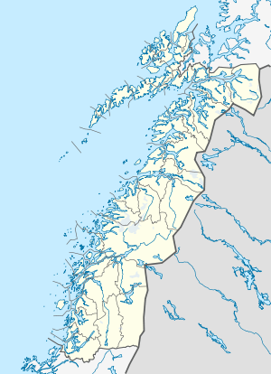 Bogen  Bogen Location in Nordland | |
| Coordinates: 68°31′34″N 16°59′45″E / 68.52611°N 16.99583°ECoordinates: 68°31′34″N 16°59′45″E / 68.52611°N 16.99583°E | |
| Country | Norway |
| Region | Northern Norway |
| County | Nordland |
| District | Ofoten |
| Municipality | Evenes |
| Area[1] | |
| • Total | 0.54 km2 (0.21 sq mi) |
| Elevation[2] | 7 m (23 ft) |
| Population (2013)[1] | |
| • Total | 363 |
| • Density | 672/km2 (1,740/sq mi) |
| Time zone | CET (UTC+01:00) |
| • Summer (DST) | CEST (UTC+02:00) |
| Post Code | 8533 Bogen i Ofoten |
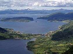
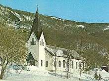
Bogen (Northern Sami: Ránda) is a village and the administrative centre of the municipality of Evenes in Nordland county, Norway. It is located along the shore of the Ofotfjorden, about 10 kilometres (6.2 mi) northeast of the village of Liland. The European route E10 highway passes through the village. Bogen Chapel is located in this village. The 0.54-square-kilometre (130-acre) village has a population (2013) of 363. The population density is 672 inhabitants per square kilometre (1,740/sq mi).[1][3]
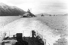
Historically, Bogen is most notable for small-scale iron ore mining in the early 20th century as well as being a German naval base during World War II, including for the German battleship Tirpitz and the heavy cruiser Admiral Hipper.[3][4]
References
- 1 2 3 Statistisk sentralbyrå (1 January 2013). "Urban settlements. Population and area, by municipality.".
- ↑ "Bogen" (in Norwegian). yr.no. Retrieved 2012-06-06.
- 1 2 Store norske leksikon. "Bogen – i Evenes" (in Norwegian). Retrieved 2012-06-06.
- ↑ Tromsø Museum. "Important years in mining history" (in Norwegian).