Bois de Sioux River
| Bois de Sioux River | |
|---|---|
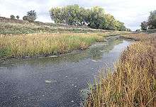 The Bois de Sioux River below the dam of Lake Traverse. Roberts County, South Dakota is at left, and Traverse County, Minnesota is at right. | |
 The Red River drainage basin, with the Bois de Sioux River highlighted | |
| Basin | |
| Main source |
Dam at the foot of Lake Traverse, South Dakota 45°51′42″N 96°34′23″W / 45.8616667°N 96.5730556°W |
| River mouth |
Confluence with the Otter Tail River to form the Red River 951 ft (290 m) 46°15′52″N 96°35′55″W / 46.2644444°N 96.5986111°WCoordinates: 46°15′52″N 96°35′55″W / 46.2644444°N 96.5986111°W |
| Progression | Bois de Sioux River → Red River → Lake Winnipeg → Nelson River → Hudson Bay → Atlantic Ocean |
| Physical characteristics | |
| Length | 41 mi (66 km) |
| Features | |
| GNIS ID | 640348 |
The Bois de Sioux River drains Lake Traverse, the southernmost body of water in the Hudson Bay watershed of North America. It is a tributary of the Red River of the North and defines part of the western border of the U.S. state of Minnesota, and the eastern borders of North Dakota and South Dakota. It is about 41 miles (66 km) in length.[1][2]
Bois de Sioux is a name derived from French meaning "Woods of the Sioux".[3]
Course
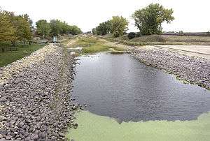
The river flows northward from a Corps of Engineers dam at the north end of Lake Traverse and shortly enters Mud Lake. Downstream of Mud Lake it is a small stream, and its flow has been channelized and straightened in some places so that the watercourse diverges slightly from the historic state boundary. It passes the town of White Rock before joining the Otter Tail River to form the Red River of the North at Wahpeton, North Dakota, and Breckenridge, Minnesota.
Tributaries
The two largest tributaries of the Bois de Sioux are the Mustinka River, which flows into Lake Traverse, and the Rabbit River south of Breckenridge; both of these enter from Minnesota.
See also
- List of rivers of Minnesota
- List of rivers of North Dakota
- List of rivers of South Dakota
- List of river borders of U.S. states
References
- ↑ U.S. Geological Survey. National Hydrography Dataset high-resolution flowline data. The National Map Archived 2012-04-05 at WebCite, accessed June 8, 2011
- ↑ U.S. Geological Survey Geographic Names Information System: Bois de Sioux River
- ↑ Upham, Warren (1920). Minnesota Geographic Names: Their Origin and Historic Significance. Minnesota Historical Society. p. 554.
- Waters, Thomas F. (1977). The Streams and Rivers of Minnesota. Minneapolis: University of Minnesota Press. ISBN 0-8166-0960-8.