Bommiers
| Bommiers | |
|---|---|
|
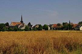
A general view of Bommiers | |
 Bommiers | |
|
Location within Centre-Val de Loire region  Bommiers | |
| Coordinates: 46°47′44″N 1°59′10″E / 46.7956°N 1.9861°ECoordinates: 46°47′44″N 1°59′10″E / 46.7956°N 1.9861°E | |
| Country | France |
| Region | Centre-Val de Loire |
| Department | Indre |
| Arrondissement | Issoudun |
| Canton | Issoudun-Sud |
| Intercommunality | Champagne berrichonne |
| Government | |
| • Mayor (2008–2014) | Bernard Allouis |
| Area1 | 28.38 km2 (10.96 sq mi) |
| Population (2009)2 | 292 |
| • Density | 10/km2 (27/sq mi) |
| Time zone | CET (UTC+1) |
| • Summer (DST) | CEST (UTC+2) |
| INSEE/Postal code | 36019 / 36120 |
| Elevation |
143–204 m (469–669 ft) (avg. 161 m or 528 ft) |
|
1 French Land Register data, which excludes lakes, ponds, glaciers > 1 km² (0.386 sq mi or 247 acres) and river estuaries. 2 Population without double counting: residents of multiple communes (e.g., students and military personnel) only counted once. | |
Bommiers is a commune in the Indre département in central France.
Population
| Historical population | ||
|---|---|---|
| Year | Pop. | ±% |
| 1793 | 565 | — |
| 1800 | 772 | +36.6% |
| 1806 | 667 | −13.6% |
| 1821 | 678 | +1.6% |
| 1831 | 676 | −0.3% |
| 1836 | 718 | +6.2% |
| 1841 | 670 | −6.7% |
| 1846 | 654 | −2.4% |
| 1851 | 700 | +7.0% |
| 1856 | 697 | −0.4% |
| 1861 | 689 | −1.1% |
| 1866 | 691 | +0.3% |
| 1872 | 674 | −2.5% |
| 1876 | 673 | −0.1% |
| 1881 | 670 | −0.4% |
| 1886 | 667 | −0.4% |
| 1891 | 674 | +1.0% |
| 1896 | 649 | −3.7% |
| 1901 | 643 | −0.9% |
| 1906 | 665 | +3.4% |
| 1911 | 622 | −6.5% |
| 1921 | 542 | −12.9% |
| 1926 | 539 | −0.6% |
| 1931 | 504 | −6.5% |
| 1936 | 490 | −2.8% |
| 1946 | 467 | −4.7% |
| 1954 | 470 | +0.6% |
| 1962 | 411 | −12.6% |
| 1968 | 363 | −11.7% |
| 1975 | 350 | −3.6% |
| 1982 | 283 | −19.1% |
| 1990 | 229 | −19.1% |
| 1999 | 260 | +13.5% |
| 2009 | 292 | +12.3% |
See also
References
| Wikimedia Commons has media related to Bommiers. |
This article is issued from Wikipedia - version of the 2/11/2016. The text is available under the Creative Commons Attribution/Share Alike but additional terms may apply for the media files.