Bondalen
| Bondalen | |
|---|---|
|
Pictures from the Work "Norge fremstillet i billeder" 1848 by Chr. Tønsberg. Bondalen, Ørsta municipality, Møre og Romsdal county, Norway. | |
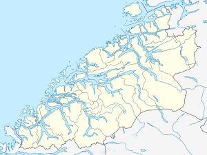
 Bondalen Location in Møre og Romsdal | |
| Floor elevation | 440 m (1,440 ft) |
| Long-axis length | 11 kilometres (6.8 mi) |
| Width | 1.5 kilometres (0.93 mi) |
| Geography | |
| Coordinates | 62°11′09″N 06°26′01″E / 62.18583°N 6.43361°ECoordinates: 62°11′09″N 06°26′01″E / 62.18583°N 6.43361°E |
| Population centers | Sæbø |
Bondalen is a valley in the Hjørundfjord area of Ørsta Municipality in Møre og Romsdal county, Norway. The 11-kilometre (6.8 mi) long, sparsely populated valley runs to the west from the Hjørundfjorden and the village of Sæbø towards the village of Volda in the west.[1]
Bondalen is located in the midst of the Sunnmørsalpene mountains, with the mountain Skårasalen just to the south. The Hjørundfjord Church, a primary and secondary school, and a number of other community services for the area are all located in the valley.
See also
References
- ↑ Store norske leksikon. "Bondalen" (in Norwegian). Retrieved 2010-09-23.
This article is issued from Wikipedia - version of the 8/5/2013. The text is available under the Creative Commons Attribution/Share Alike but additional terms may apply for the media files.
