Brain-sur-Longuenée
| Brain-sur-Longuenée | |
|---|---|
|
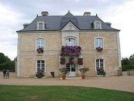
Town hall | |
 Brain-sur-Longuenée | |
|
Location within Pays de la Loire region  Brain-sur-Longuenée | |
| Coordinates: 47°35′08″N 0°45′39″W / 47.5856°N 0.7608°WCoordinates: 47°35′08″N 0°45′39″W / 47.5856°N 0.7608°W | |
| Country | France |
| Region | Pays de la Loire |
| Department | Maine-et-Loire |
| Arrondissement | Segré |
| Canton | Tiercé |
| Intercommunality | Le Lion-d'Angers |
| Government | |
| • Mayor (2008–2014) | Jean Poussin |
| Area1 | 22.43 km2 (8.66 sq mi) |
| Population (2009)2 | 978 |
| • Density | 44/km2 (110/sq mi) |
| Time zone | CET (UTC+1) |
| • Summer (DST) | CEST (UTC+2) |
| INSEE/Postal code | 49043 / 49220 |
| Elevation |
41–102 m (135–335 ft) (avg. 78 m or 256 ft) |
|
1 French Land Register data, which excludes lakes, ponds, glaciers > 1 km² (0.386 sq mi or 247 acres) and river estuaries. 2 Population without double counting: residents of multiple communes (e.g., students and military personnel) only counted once. | |
Brain-sur-Longuenée is a former commune in the Maine-et-Loire department in western France. On 28 December 2015, it was merged into the new commune Erdre-en-Anjou.[1]
Population
| Historical population | ||
|---|---|---|
| Year | Pop. | ±% |
| 1793 | 928 | — |
| 1800 | 843 | −9.2% |
| 1806 | 1,002 | +18.9% |
| 1821 | 1,010 | +0.8% |
| 1831 | 1,068 | +5.7% |
| 1836 | 1,053 | −1.4% |
| 1841 | 1,054 | +0.1% |
| 1846 | 1,064 | +0.9% |
| 1851 | 1,010 | −5.1% |
| 1856 | 1,037 | +2.7% |
| 1861 | 1,063 | +2.5% |
| 1866 | 1,101 | +3.6% |
| 1872 | 1,037 | −5.8% |
| 1876 | 1,027 | −1.0% |
| 1881 | 1,043 | +1.6% |
| 1886 | 1,078 | +3.4% |
| 1891 | 978 | −9.3% |
| 1896 | 927 | −5.2% |
| 1901 | 866 | −6.6% |
| 1906 | 853 | −1.5% |
| 1911 | 851 | −0.2% |
| 1921 | 774 | −9.0% |
| 1926 | 750 | −3.1% |
| 1931 | 723 | −3.6% |
| 1936 | 675 | −6.6% |
| 1946 | 644 | −4.6% |
| 1954 | 653 | +1.4% |
| 1962 | 602 | −7.8% |
| 1968 | 568 | −5.6% |
| 1975 | 513 | −9.7% |
| 1982 | 574 | +11.9% |
| 1990 | 669 | +16.6% |
| 1999 | 769 | +14.9% |
| 2006 | 927 | +20.5% |
| 2009 | 978 | +5.5% |
See also
References
- ↑ Arrêté préfectoral 23 December 2015 (French)
External links
| Wikimedia Commons has media related to Brain-sur-Longuenée. |
This article is issued from Wikipedia - version of the 1/18/2016. The text is available under the Creative Commons Attribution/Share Alike but additional terms may apply for the media files.