Brak River
| Brak River | |
| River | |
| Country | South Africa |
|---|---|
| Province | Limpopo |
| Tributaries | |
| - left | Ga-Mamasonya, Boshela |
| Source | |
| - location | Makgabeng Plateau |
| Mouth | Sand River (Polokwane) |
| - location | Limpopo Province |
| - elevation | 612 m (2,008 ft) |
| - coordinates | 22°36′15″S 29°44′0″E / 22.60417°S 29.73333°ECoordinates: 22°36′15″S 29°44′0″E / 22.60417°S 29.73333°E |
| Length | 170 km (106 mi) |
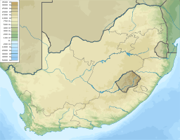 Location of the Brak River's mouth
| |
The Brak River (Afrikaans: Brakrivier) is a river located in northern Limpopo Province, South Africa. It is a tributary of the Sand River (Polokwane).
Course
The Brak River starts on the east of the Makgabeng Plateau and flows north-northeast until reaching the Blouberg, skirting the massif and flowing diagonally northeastwards between the Blouberg and the Soutpansberg.[1] Then it meanders through the Lowveld until it joins the left bank of the Sand River about 45 kilometres (28 mi) to the southwest of Musina. The Brak River is an intermittent stream.
This river should not be confused with the Great Brak River of the Western Cape.
See also
References
External links
This article is issued from Wikipedia - version of the 3/13/2016. The text is available under the Creative Commons Attribution/Share Alike but additional terms may apply for the media files.