Brassac-les-Mines
| Brassac-les-Mines | ||
|---|---|---|
|
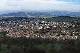
View of the town from Marnat. | ||
| ||
 Brassac-les-Mines | ||
|
Location within Auvergne-Rhône-Alpes region  Brassac-les-Mines | ||
| Coordinates: 45°24′53″N 3°19′47″E / 45.4147°N 3.3297°ECoordinates: 45°24′53″N 3°19′47″E / 45.4147°N 3.3297°E | ||
| Country | France | |
| Region | Auvergne-Rhône-Alpes | |
| Department | Puy-de-Dôme | |
| Arrondissement | Issoire | |
| Canton | Brassac-les-Mines[1] | |
| Intercommunality | Communauté de communes du Bassin minier Montagne | |
| Government | ||
| • Mayor (2014-2020) | Yves-Serge Croze | |
| Area1 | 7.20 km2 (2.78 sq mi) | |
| Population (2013)2 | 3,291 | |
| • Density | 460/km2 (1,200/sq mi) | |
| Time zone | CET (UTC+1) | |
| • Summer (DST) | CEST (UTC+2) | |
| INSEE/Postal code | 63050 / 63570 | |
| Elevation |
395–533 m (1,296–1,749 ft) (avg. 409 m or 1,342 ft) | |
| Website | http://www.brassaclesmines.fr/ | |
|
1 French Land Register data, which excludes lakes, ponds, glaciers > 1 km² (0.386 sq mi or 247 acres) and river estuaries. 2 Population without double counting: residents of multiple communes (e.g., students and military personnel) only counted once. | ||
.svg.png)
Brassac-les-Mines is a commune in the Puy-de-Dôme department in Auvergne-Rhône-Alpes in central France.
Population
| Historical population | ||
|---|---|---|
| Year | Pop. | ±% |
| 1990 | 3,446 | — |
| 1999 | 3,249 | −5.7% |
| 2006 | 3,287 | +1.2% |
| 2009 | 3,271 | −0.5% |
| 2013 | 3,291 | +0.6% |
| Source: INSEE | ||
See also
| Wikimedia Commons has media related to Brassac-les-Mines. |
References
- ↑ "Décret 2014-210 du 21 février 2014 portant délimitation des cantons dans le département du Puy-de-Dôme" [2014-210 decree delimiting cantons of Puy-de-Dôme department]. Légifrance (in French). 21 February 2014. Retrieved 7 August 2016.
This article is issued from Wikipedia - version of the 11/11/2016. The text is available under the Creative Commons Attribution/Share Alike but additional terms may apply for the media files.