Bretteville, Manche
| Bretteville-en-Saire | |
|---|---|
|
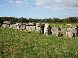
The covered way | |
 Bretteville-en-Saire | |
|
Location within Normandy region  Bretteville-en-Saire | |
| Coordinates: 49°39′25″N 1°31′10″W / 49.6569°N 1.5194°WCoordinates: 49°39′25″N 1°31′10″W / 49.6569°N 1.5194°W | |
| Country | France |
| Region | Normandy |
| Department | Manche |
| Arrondissement | Cherbourg-Octeville |
| Canton | Tourlaville |
| Intercommunality | Saire |
| Government | |
| • Mayor (2008–2014) | Daniel Roupsard |
| Area1 | 5.78 km2 (2.23 sq mi) |
| Population (2009)2 | 1,055 |
| • Density | 180/km2 (470/sq mi) |
| Time zone | CET (UTC+1) |
| • Summer (DST) | CEST (UTC+2) |
| INSEE/Postal code | 50077 / 50110 |
| Elevation |
0–156 m (0–512 ft) (avg. 69 m or 226 ft) |
|
1 French Land Register data, which excludes lakes, ponds, glaciers > 1 km² (0.386 sq mi or 247 acres) and river estuaries. 2 Population without double counting: residents of multiple communes (e.g., students and military personnel) only counted once. | |
Bretteville is a commune in the Manche department in Normandy in northwestern France.
Population
| Historical population | ||
|---|---|---|
| Year | Pop. | ±% |
| 1793 | 660 | — |
| 1800 | 623 | −5.6% |
| 1806 | 671 | +7.7% |
| 1821 | 686 | +2.2% |
| 1831 | 683 | −0.4% |
| 1836 | 650 | −4.8% |
| 1841 | 603 | −7.2% |
| 1846 | 589 | −2.3% |
| 1851 | 594 | +0.8% |
| 1856 | 589 | −0.8% |
| 1861 | 603 | +2.4% |
| 1866 | 579 | −4.0% |
| 1872 | 545 | −5.9% |
| 1876 | 522 | −4.2% |
| 1881 | 504 | −3.4% |
| 1886 | 462 | −8.3% |
| 1891 | 456 | −1.3% |
| 1896 | 473 | +3.7% |
| 1901 | 446 | −5.7% |
| 1906 | 482 | +8.1% |
| 1911 | 515 | +6.8% |
| 1921 | 427 | −17.1% |
| 1926 | 432 | +1.2% |
| 1931 | 442 | +2.3% |
| 1936 | 429 | −2.9% |
| 1946 | 534 | +24.5% |
| 1954 | 478 | −10.5% |
| 1962 | 456 | −4.6% |
| 1968 | 455 | −0.2% |
| 1975 | 542 | +19.1% |
| 1982 | 680 | +25.5% |
| 1990 | 1,008 | +48.2% |
| 1999 | 1,075 | +6.6% |
| 2009 | 1,055 | −1.9% |
See also
References
| Wikimedia Commons has media related to Bretteville. |
This article is issued from Wikipedia - version of the 3/14/2015. The text is available under the Creative Commons Attribution/Share Alike but additional terms may apply for the media files.