Bukhan River
| Bukhan (북한강) | |
| River | |
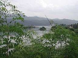 The Bukhan River flowing through Gapyeong, South Korea. | |
| Countries | North Korea (PRK), South Korea (KOR) |
|---|---|
| Provinces | Kangwon (PRK), Gangwon (KOR), Gyeonggi (KOR) |
| Tributaries | |
| - right | Yanggu Seocheon, Soyang River |
| Source | Taebaek Mountains [1][2] |
| - location | Okpat Peak, Kumgang, Kangwon, North Korea [lower-alpha 1] |
| Mouth | Han River |
| - location | Lake Paldang, Gyeonggi, South Korea |
| Length | 482 km (300 mi) [3] |
| Basin | 23,292 km2 (8,993 sq mi) [3] |
| Bukhan River | |
| Hangul | 북한강 |
|---|---|
| Hanja | 北漢江 |
| Revised Romanization | Bukhan-gang |
| McCune–Reischauer | Pukhan'gang |
The Bukhan River (North Han River) is a tributary of the Han River that flows through both North and South Korea. It traverses Kangwon province in North Korea and Gangwon and Gyeonggi provinces in South Korea.
The Bukhan River's headwaters lie in North Korea near Geumgangsan; this early portion of the river is often called the Geumgangcheon, or "Geumgang Stream." It crosses the Korean Demilitarized Zone and enters Hwacheon County, flowing south through Chuncheon and then west through Gapyeong. It joins with the Namhan River in Yangseo-myeon, Yangpyeong, to form the Han River.
Notes
- ↑ Okpat Peak (1,240.7m, Chosŏn'gŭl: 옥밭봉; Hancha: 옥밭峰; MR: Okpat'pong)
The peak is also known as Okbal Peak (옥발봉) or Okjeon Peak (옥전봉) in the South.
References
- ↑ 북한지도집 [Map of North Korea] (PDF) (in Korean). National Geographic Information Institute, Republic of Korea. November 2013. pp. 182–183. Retrieved 7 July 2014. External link in
|publisher=(help) - ↑ 2013년 한국하천일람 [List of Rivers of South Korea, 2013] (PDF) (in Korean). Han River Flood Control Office, Republic of Korea. 31 December 2012. p. 28. Retrieved 7 July 2014. External link in
|publisher=(help) - 1 2 HRFCO 2012, pp. 96-97.
Coordinates: 37°31′36″N 127°18′38″E / 37.52667°N 127.31056°E
This article is issued from Wikipedia - version of the 6/27/2016. The text is available under the Creative Commons Attribution/Share Alike but additional terms may apply for the media files.