Bukomero
| Bukomero | |
|---|---|
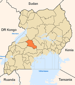
 Bukomero Location in Uganda | |
| Coordinates: 00°41′22″N 32°02′20″E / 0.68944°N 32.03889°ECoordinates: 00°41′22″N 32°02′20″E / 0.68944°N 32.03889°E | |
| Country |
|
| Region | Central Region |
| District | Kiboga District |
| Municipality | Bukomero Municipality |
| County | Ssingo |
| Sub-county | Bukomero sub-county |
| Elevation | 3,900 ft (1,200 m) |
Bukomero is a town in Ssingo County, Kiboga District, in the Central Region of Uganda.
Location
The town is located on the Kampala–Hoima Road, approximately 92 kilometres (57 mi), northwest of Kampala, the capital and largest city of Uganda.[1] The coordinates of Bukomero are 0°41'22.0"N, 32°02'20.0"E (Latitude:0.689444; Longitude:32.038889).[2]
Overview
Bukomero is on a relative plateau surrounded by hilly, rocky, infertile, and often bare terrain. Most economic activity takes place in the lower, more accessible, fertile plains. Commercial and administrative activities in the town center include small scale family shops ("dduukas"), a farmers market, and a sub-county headquarters. Public service facilities include one public health center, one public elementary school, and one public secondary school. The area is prone to water shortages.[3][4]
See also
References
- ↑ "Travel Distance Between Kampala And Bukomero With Map". Globefeed.com. Retrieved 1 September 2014.
- ↑ Google (5 July 2015). "Location of Bukomero At Google Maps" (Map). Google Maps. Google. Retrieved 5 July 2015.
- ↑ Dibele, Denis (27 December 2011). "Water Shortage Hits Bukomero". New Vision (Kampala). Retrieved 1 September 2014.
- ↑ Embassy of Japan (24 August 2011). "The Project for Improvement of Access to Safe Water in Bukomero Town in Kiboga District". Embassy of Japan to Uganda. Retrieved 5 July 2015.
External links
Capital: Kiboga | ||
| Counties and sub-counties |
|  |
| Towns and villages | ||
| Banking | ||
| Health | ||
| Transport | ||
| Notable people | ||