Burrough Green

| Burrough Green | |
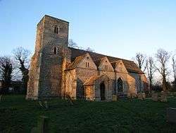 Burrough Green church |
|
 Burrough Green |
|
| Population | 378 (2011) |
|---|---|
| OS grid reference | TL641548 |
| Shire county | Cambridgeshire |
| Region | East |
| Country | England |
| Sovereign state | United Kingdom |
| Post town | Newmarket |
| Postcode district | CB |
| EU Parliament | East of England |
| Website | http://www.burroughgreen.com |
|
|
Coordinates: 52°10′N 0°24′E / 52.17°N 0.4°E
Burrough Green is a village and parish in Cambridgeshire, England.[1][2] The population of the village at the 2011 census was 378.[3] Described in Kelly's Directory (1929) as a "village and parish 2½ miles south-east from Dullingham station on the Cambridge and Bury branch of the London and North Eastern Railway and 6 south from Newmarket, in the hundred of Radfield, Newmarket union, petty sessional division and county court district, rural deanery of Cheveley, archdeaconry and diocese of Ely."
The Reading Room at Burrough Green was built in 1887 by Mrs Porcher, as a memorial to her husband, Charles Porcher esq.; it is in gener.<>al use during the winter months, and will hold about 130 persons. The Old Hall (or Manor House), which stands near the church, is now a farmhouse. The soil is various; subsoil, clay and chalk. The chief crops are wheat, barley and roots. The area of the parish is 2,272 acres (919 ha); the population in 1921 was 334."
Burrough Green Primary School has been in existence for over 400 years. It provides an education for around 100 children. There is also an after school club and a nursery on site. The school uses the reading room mentioned above for lunch times and also has a small swimming pool.
The Icknield Way Path passes through the village on its 110 mile journey from Ivinghoe Beacon in Buckinghamshire to Knettishall Heath in Suffolk. The Icknield Way Trail, a multi-user route for walkers, horse riders and off-road cyclists also passes through the village.
There is also a cricket club in the village which plays on the village green and competes with other local villages.
References
- ↑ Ordnance Survey: Landranger map sheet 154 Cambridge & Newmarket (Saffron Walden) (Map). Ordnance Survey. 2012. ISBN 9780319231739.
- ↑ "Ordnance Survey: 1:50,000 Scale Gazetteer" (csv (download)). www.ordnancesurvey.co.uk. Ordnance Survey. 1 January 2016. Retrieved 30 January 2016.
- ↑ "Civil Parish population 2011". Neighbourhood Statistics. Office for National Statistics. Retrieved 14 July 2016.
External links
| Wikimedia Commons has media related to Burrough Green. |