Camp Clarke Bridge Site
|
Camp Clarke Bridge Site | |
 | |
| Nearest city | Bridgeport, Nebraska |
|---|---|
| Area | 120 acres (49 ha) |
| Built | 1875 |
| Built by | Clarke,Henry T. |
| NRHP Reference # | 74001129[1] |
| Added to NRHP | November 8, 1974 |
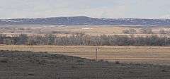
The Camp Clarke Bridge Site in Morrill County, Nebraska near Bridgeport dates from 1875. Also known as 25 MO 68, it was listed on the National Register of Historic Places in 1974.[1]
It is the location of a toll bridge built in 1875 by entrepreneur Henry T. Clarke, who provided a crossing over the North Platte River for what became the Sidney-Black Hills Trail. The trail provided access for freight wagons, stagecoaches and other vehicles headed to and from the Dakota gold fields, from the Union Pacific railway trailhead at Fort Sidney, Nebraska.[2]
It is about 9 miles east from Chimney Rock and three miles west of Bridgeport, Nebraska. Historic photos show a wooden truss bridge built on pilings in the soft ground of the river. It was "a massive structure...two thousand feet in length with a solid six to one truss span." It was the only reliable crossing between Fort Laramie and North Platte, Nebraska.[2]
At the time of the NRHP listing in 1974, the North Platte no longer flowed through the bridge location, but was rather slightly to the north.[2]
See also
- Greenwood Stage Station, also on the Sidney-Black Hills Trail, also NRHP-listed
References
- 1 2 National Park Service (2010-07-09). "National Register Information System". National Register of Historic Places. National Park Service.
- 1 2 3 Ronald L. Kivett (May 15, 1974). "National Register of Historic Places Inventory/Nomination: Camp Clarke Bridge Site" (PDF). National Park Service. and accompanying seven photos, historic and up to 1965
| Wikimedia Commons has media related to Camp Clarke bridge site (Morrill County, Nebraska). |
| Topics | |
|---|---|
| Lists by states |
|
| Lists by insular areas | |
| Lists by associated states | |
| Other areas | |
| |