Camp Parapet
|
Camp Parapet Powder Magazine | |
|
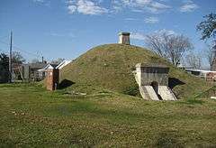
The Camp Parapet powder magazine in 2008 | |
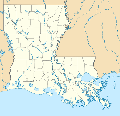  | |
| Location | Arlington St., E of Causeway Blvd., Metairie, Louisiana |
|---|---|
| Coordinates | 29°57′39″N 90°9′20″W / 29.96083°N 90.15556°WCoordinates: 29°57′39″N 90°9′20″W / 29.96083°N 90.15556°W |
| Area | less than one acre |
| NRHP Reference # | 77000671[1] |
| Added to NRHP | May 24, 1977 |
Camp Parapet was a Civil War fortification at Shrewsbury, Jefferson Parish, Louisiana, a bit more than a mile upriver from the current city limits of New Orleans.
History
The fortification consisted of a Confederate defensive line about a mile and 3/4 long stretching from the Mississippi River northward to Metairie Ridge. (The area further north from the ridge to Lake Pontchartrain was at the time swampland.) This was intended to protect the city of New Orleans from Union attack from upriver. As the Union fleet took the city by sailing in from below, the fortification was never used. After the capture of New Orleans, U.S. forces garrisoned and expanded the fortifications to defend against a Confederate counter-attack, which never came.
Under Union control, the Camp lay in the district of Brigadier General Thomas W. Sherman. In late-September 1862, Halbert E. Paine, captain of the Fourth Wisconsin Volunteer Regiment, assumed command of the camp. George H. Hanks, a lieutenant in the 12th Connecticut Infantry Regiment was detailed as Aide de Camp for Sherman for the superintendence of the many contraband arriving at the camp. He organized six colonies at Camp Parapet each led by a non-commissioned officer and directed black labor in the repair and fortification of the camp and surroundings.[2] This scheme was expanded under Hanks to become the Bureau of Negro Labor, which was one of the organizations which would eventually become the Freedmen's Bureau.[3]
Remains
Powder magazine
The only remaining structure of the fortification is the powder magazine, of brick enclosed in an earth mound. It is located off Causeway Boulevard near the American Legion Post 267, preserved in a small park and added to the National Register of Historic Places in 1977.
Cemetery site
Nearby is the historic Shrewsbury (Camp Parapet) Cemetery, the site of the camp's cemetery, where 7,000 Union bodies were once interred before being moved to Chalmette National Cemetery.
See also
References
- ↑ National Park Service (2010-07-09). "National Register Information System". National Register of Historic Places. National Park Service.
- ↑ Paine, Halbert Eleazer. A Wisconsin Yankee in Confederate Bayou Country: The Civil War Reminiscences of a Union General. LSU Press, 1 May 2009, diary entry September 29, 1862
- ↑ Ripley, C. Peter. Slaves and Freedmen in Civil War Louisiana. Baton Rouge: Louisiana State University Press, 1976
External links
| Wikimedia Commons has media related to Camp Parapet. |
- New Orleans area Forts with information on Camp Parapet.