Canim Lake (British Columbia)
| Canim Lake | |
|---|---|
 | |
| Location | British Columbia |
| Coordinates | 51°51′47″N 120°45′56″W / 51.86314°N 120.76542°WCoordinates: 51°51′47″N 120°45′56″W / 51.86314°N 120.76542°W |
| Primary inflows | Bridge Creek, Eagle Creek, Neff Creek, Jim Creek, Roserim Creek, Boss Creek |
| Primary outflows | Canim River |
| Basin countries | Canada |
| Max. length | 26.5 km (16 mi) |
| Surface area | 56.1 km2 (22 sq mi) |
| Average depth | 84.1 m (276 ft) |
| Max. depth | 208.5 m (684 ft) |
| Water volume | 4.7 km3 (1 cu mi) |
| Surface elevation | 772.4 m (2,534 ft) |
| Frozen | Rarely |
| Islands | Eagle Island, Canoe Island, Johnson Island, Round Island, Sunken Island/Reef |
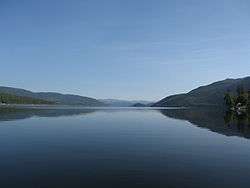
Canim Lake is a lake in British Columbia, Canada. Its west end is 36 km (22.4 mi) northeast of 100 Mile House. "Canim" means a type of large canoe in the Chinook Jargon. Canim Lake is 26.5 km (16.5 mi) long. It is also part of the territory of the Shuswap First Nation where the ancestors are part of the Lake Division of the Shuswap Tribe of the Interior Nations of British Columbia. The Reilly Commission states that the 2,029 hectares region around Canim Lake are set aside for the Shuswap First Nation. In the summer of 1995, there was an archaeological evidence of an ancient civilization and evidence of carbon dated as 4,300 old.[1]
Activities
Canim Lake is known for its summer and winter activities. During the summer, activities like fishing, hiking, horseback riding, canoeing and kayaking can be enjoyed. Many lodges located around the lake provide horse adventures for both novice and experienced riders. Some lodges provide overnight trips or one week trips. Since there is a huge area of backcountry, activities like hiking and mountain biking can be done during the summer. Canim Lake is also a well known area to go freshwater fishing. Many types of fish can be caught like the Kokanee, rainbow trout, lake trout, and the lingcod. Wildlife can be seen such as black bears, moose, deer, wolves, coyotes, cougars, beavers, otters, waterfowl, hawks, bald eagles and song birds.[1][2] Winter activities include snowmobiling, cross-country skiing, dogsledding and ice fishing.
Places to See
Canim Falls can be reached from the south side of the lake. It is 25 m (82 ft) high. The Canim River has cut into a lava plateau that came from the Wells Gray Clearwater Volcanic Field. The falls are located in Wells Gray Provincial Park.[3][4]
Provincial parks around Canim Lake
Private Resorts and Campsites
- Canim Lake Resort
- KAYANARA Guest Ranch & Resort
- Minac Holiday Village
- Ponderosa Resort
- Rainbow Resort
- Reynolds Resort
Fishing
Canim Lake is host to numerous fish species including Rainbow Trout, Lake Trout, Kokanee and Burbot. Online records indicate the Government of British Columbia has stocked Canim Lake sporadically with hatchery reared Kokanee and Rainbow Trout between 1938 and 1998.
Settlement
The settlement Canim Lake of the Canim Lake Band is located west of the lake.
References
- 1 2 "Canim Lake". Travel British Columbia. Retrieved 30 March 2014.
|first1=missing|last1=in Authors list (help) - ↑ "Canim Beach Provincial Park". BC Parks. Retrieved 30 March 2014.
- ↑ Neave, Roland (2015). Exploring Wells Gray Park, 6th edition. Wells Gray Tours, Kamloops, BC. ISBN 978-0-9681932-2-8.
- ↑ "Wells Gray Country British Columbia". Tourism Wells Gray. Retrieved 1 April 2014.