Cape Annawan

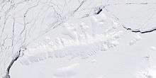
Cape Annawan (72°20′S 95°25′W / 72.333°S 95.417°WCoordinates: 72°20′S 95°25′W / 72.333°S 95.417°W) is an ice-covered cape which marks the east extremity of Thurston Island and the northwest entrance to Seraph Bay in Antarctica. Discovered in helicopter flights from the USS Burton Island and Glacier by personnel of the U.S. Navy Bellingshausen Sea Expedition in February 1960. Named by Advisory Committee on Antarctic Names (US-ACAN) for the ship Annawan, of the United States Expedition of 1829-31, which with the Penguin sailed west from the South Shetland Islands in February 1830, holding a course between 62S and 58S and exploring as far as 103W, northward of this cape.
Maps
- Thurston Island – Jones Mountains. 1:500000 Antarctica Sketch Map. US Geological Survey, 1967.
- Antarctic Digital Database (ADD). Scale 1:250000 topographic map of Antarctica. Scientific Committee on Antarctic Research (SCAR), 1993–2016.
![]() This article incorporates public domain material from the United States Geological Survey document "Cape Annawan" (content from the Geographic Names Information System).
This article incorporates public domain material from the United States Geological Survey document "Cape Annawan" (content from the Geographic Names Information System).