Cape Walker

Map of Thurston Island.
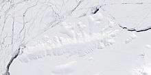
Satellite image of Thurston Island.
Cape Walker (72°33′S 95°57′W / 72.550°S 95.950°WCoordinates: 72°33′S 95°57′W / 72.550°S 95.950°W) is an ice-covered cape which forms the southeast end of Thurston Island. Named by Advisory Committee on Antarctic Names (US-ACAN) after Captain Edward K. Walker, captain of the Canisteo, a tanker in the Eastern Group of U.S. Navy Operation Highjump, 1946-47.
Maps
- Thurston Island – Jones Mountains. 1:500000 Antarctica Sketch Map. US Geological Survey, 1967.
- Antarctic Digital Database (ADD). Scale 1:250000 topographic map of Antarctica. Scientific Committee on Antarctic Research (SCAR). Since 1993, regularly upgraded and updated.
![]() This article incorporates public domain material from the United States Geological Survey document "Cape Walker" (content from the Geographic Names Information System).
This article incorporates public domain material from the United States Geological Survey document "Cape Walker" (content from the Geographic Names Information System).
This article is issued from Wikipedia - version of the 1/31/2016. The text is available under the Creative Commons Attribution/Share Alike but additional terms may apply for the media files.