Capendu
| Capendu | ||
|---|---|---|
|
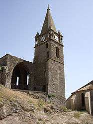
Ruins of the chateau | ||
| ||
 Capendu | ||
|
Location within Occitanie region  Capendu | ||
| Coordinates: 43°11′06″N 2°33′37″E / 43.185°N 2.5603°ECoordinates: 43°11′06″N 2°33′37″E / 43.185°N 2.5603°E | ||
| Country | France | |
| Region | Occitanie | |
| Department | Aude | |
| Arrondissement | Carcassonne | |
| Canton | Capendu | |
| Intercommunality | Piémont d'Alaric | |
| Government | ||
| • Mayor (2008–2014) | Jean-Jacques Camel | |
| Area1 | 15.12 km2 (5.84 sq mi) | |
| Population (2008)2 | 1,525 | |
| • Density | 100/km2 (260/sq mi) | |
| Time zone | CET (UTC+1) | |
| • Summer (DST) | CEST (UTC+2) | |
| INSEE/Postal code | 11068 / 11700 | |
| Elevation |
59–461 m (194–1,512 ft) (avg. 83 m or 272 ft) | |
|
1 French Land Register data, which excludes lakes, ponds, glaciers > 1 km² (0.386 sq mi or 247 acres) and river estuaries. 2 Population without double counting: residents of multiple communes (e.g., students and military personnel) only counted once. | ||

Capendu is a commune in the Aude department in southern France.
Etymology
Mentioned in the form Campendud 1071. Occitan “sloping field”, “inclined field”. Fortuitous homophony with Capendu, hamlet of Blainville-Crevon (Seine-Maritime) which means “hung cat”. Armorial bearings
History
One finds potteries dating about 20.000 years ago in the Mayrac locality. The traces reveal a Roman camp site near the placement of the windmill of Roque Del Die (Occitan for Rock of God).
Population
| Historical population | ||
|---|---|---|
| Year | Pop. | ±% |
| 1962 | 1,407 | — |
| 1968 | 1,413 | +0.4% |
| 1975 | 1,160 | −17.9% |
| 1982 | 1,198 | +3.3% |
| 1990 | 1,291 | +7.8% |
| 1999 | 1,380 | +6.9% |
| 2008 | 1,525 | +10.5% |
Events
For seven years, FestiVoix, organized by the community of communes, has invited choral societies and artists.
See also
References
| Wikimedia Commons has media related to Capendu. |
This article is issued from Wikipedia - version of the 2/21/2013. The text is available under the Creative Commons Attribution/Share Alike but additional terms may apply for the media files.