Castle Rock (Colorado)
This article is about the butte in Colorado. For the town named after it, see Castle Rock, Colorado.
| Castle Rock | |
|---|---|
 | |
| Highest point | |
| Elevation | 6,590 ft (2,010 m) |
| Prominence | 370 ft (110 m) |
| Coordinates | 39°22′44.72″N 104°51′21.79″W / 39.3790889°N 104.8560528°WCoordinates: 39°22′44.72″N 104°51′21.79″W / 39.3790889°N 104.8560528°W |
| Geography | |
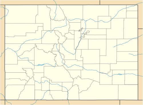 Castle Rock Location in Colorado | |
| Location |
Castle Rock, Colorado, United States |
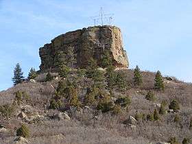
Castle Rock is a butte in the Colorado Piedmont region of the Great Plains.[1][2] An area landmark, it is located in as well as the namesake of the town of Castle Rock, Colorado.[3]
The butte's caprock consists of rhyolite, rock which is strongly resistant to erosion. About 37 million years ago, a volcanic eruption took place that covered the area around Castle Rock with 20 feet (6.1 m) of rhyolite. After a few million years, mass flooding and erosion of the volcanic rock gave way to the castle-shaped butte visible today.[4]
References
- ↑ "Colorado Geology Overview". Colorado Geology Photojournals - A Tribute to Colorado's Physical Past and Present. Retrieved 2013-10-01.
- ↑ "Physiographic Provinces of Colorado". Colorado Geological Survey. Retrieved 2013-10-01.
- ↑ Dawson, John Frank (1954). Place names in Colorado: why 700 communities were so named, 150 of Spanish or Indian origin. Denver, CO: The J. Frank Dawson Publishing Co. p. 13.
- ↑ Johnson, Kirk R.; et al. (2006). Ancient Denvers. Fulcrum Publishing. ISBN 978-1-55591-554-4.
This article is issued from Wikipedia - version of the 6/25/2016. The text is available under the Creative Commons Attribution/Share Alike but additional terms may apply for the media files.