Cayuga Creek
| Cayuga Creek | |
| Country | United States |
|---|---|
| State | New York |
| Region | Western New York |
| Source | |
| - location | Wyoming County |
| - coordinates | 42°42′48″N 78°21′53″W / 42.71333°N 78.36472°W [1] |
| Mouth | Buffalo River |
| - location | Erie County |
| - coordinates | 42°52′12″N 78°47′10″W / 42.87000°N 78.78611°WCoordinates: 42°52′12″N 78°47′10″W / 42.87000°N 78.78611°W [1] |
| Discharge | for Lancaster, New York |
| - average | 139 cu ft/s (4 m3/s) [2] |
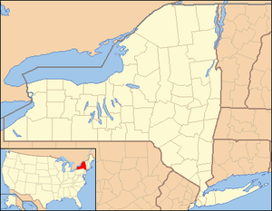 Location of the mouth of Cayuga Creek in New York State.
| |
Cayuga Creek is a small stream in western New York, United States, with stretches in both Erie County and Wyoming County.[1] The creek enters Buffalo Creek in the northwest corner of the Town of West Seneca in Erie County, just upstream from the New York State Thruway crossing. At that point, Buffalo Creek becomes the Buffalo River and flows into Lake Erie near Buffalo, New York.
The creek is named after the Cayuga nation, one of the constituent members of the Iroquois Confederacy.
Cities and settlements
The watershed of Cayuga Creek includes the towns of Alden, Cheektowaga, Elma, Lancaster, and Marilla in Erie County and the towns of Bennington and Sheldon in Wyoming County. Village centers along Cayuga Creek include Lancaster and Depew.
A sewage treatment facility in the Town of Cheektowaga discharges in to Cayuga Creek upstream of Borden Road. Downstream from Borden Road the creek runs along the Indian Road landfill.
Parks and history
Cayuga Creek runs through the Lancaster Country Club and Como Lake Park in the Town of Lancaster. The Lancaster Country Club diverts some creek water for golf course irrigation.[3] In Como Lake Park, the creek is dammed upstream of Lake Avenue. Farther downstream the creek is an important feature in Stiglemeyer Park in the Town of Cheektowaga.
After Cayuga Creek flooded the Village of Lancaster twice in the early 1940s,[4] protective dikes were constructed.
See also
References
- 1 2 3 "Cayuga Creek". Geographic Names Information System. United States Geological Survey. Retrieved March 8, 2015.
- ↑ "04215000 Cayuga Creek near Lancaster, NY" (PDF). National Water Information System. U.S. Geological Survey. 1993–2013. Retrieved April 4, 2015.
- ↑ "USGS 04215000 CAYUGA CREEK NR LANCASTER NY". National Water Information System. U.S. Geological Survey. Retrieved March 8, 2015.
- ↑ "Cayuga Creek at Lancaster". Advanced Hydrologic Prediction Service. National Weather Service. Retrieved March 8, 2015.