Center for Coastal & Ocean Mapping
Coordinates: 43°08′08″N 70°56′22″W / 43.13556°N 70.93944°W
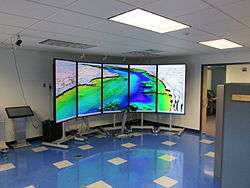
The Center for Coastal & Ocean Mapping (CCOM) / NOAA-UNH Joint Hydrographic Center (JHC) was founded in 2000 by Dr. Larry Mayer to find ways to process the massive amounts of data coming from sonar systems at rates commensurate with data collection; that is, to make the data ready for chart production as rapidly as the data could be collected.
The center is located in the Chase Ocean Engineering building on the campus of the University of New Hampshire in Durham, New Hampshire, United States.
The center works on a wide range of marine research topics, including:
- Hydrography
- Improved bathymetric processing
- Improved side-scan sonar and backscatter processing
- Data Visualization with emphasis on whale tracking, flow visualization, and mid-water fish
- Seafloor characterization
- Lidar
- Photographic mosaic
- Law of the Sea mapping for the United States
- Electronic chart of the future and the marine Automatic Identification System
- Acoustic positioning and tracking
See also
External links
This article is issued from Wikipedia - version of the 11/20/2016. The text is available under the Creative Commons Attribution/Share Alike but additional terms may apply for the media files.