Cerina
- for the village in Croatia see Cerina, Croatia
| Cerina | |
|---|---|
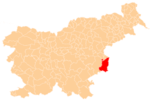
 Cerina Location in Slovenia | |
| Coordinates: 45°52′43.33″N 15°36′26.2″E / 45.8787028°N 15.607278°ECoordinates: 45°52′43.33″N 15°36′26.2″E / 45.8787028°N 15.607278°E | |
| Country |
|
| Traditional region | Lower Carniola |
| Statistical region | Lower Sava |
| Municipality | Brežice |
| Area | |
| • Total | 1.13 km2 (0.44 sq mi) |
| Elevation | 223.9 m (734.6 ft) |
| Population (2002) | |
| • Total | 141 |
| [1] | |
Cerina (pronounced [tsɛˈɾiːna]; German: Zerina[2]) is a settlement south of Čatež ob Savi in the Municipality of Brežice in eastern Slovenia. The area was traditionally part of Lower Carniola. It is now included with the rest of the municipality in the Lower Sava Statistical Region.[3]
A 17th-century mansion in the settlement was originally the estate of the Kostanjevica Monastery. Three sides around the central courtyard are living quarters and the fourth side is closed off with a chapel dedicated to Saint Michael.[4]
References
- ↑ Statistical Office of the Republic of Slovenia
- ↑ Leksikon občin kraljestev in dežel zastopanih v državnem zboru, vol. 6: Kranjsko. 1906. Vienna: C. Kr. Dvorna in Državna Tiskarna, p. 68.
- ↑ Brežice municipal site
- ↑ Slovenian Ministry of Culture register of national heritage reference number 10539
External links
%2C_Bre%C5%BEice.jpg)
FILTH
This article is issued from Wikipedia - version of the 9/8/2014. The text is available under the Creative Commons Attribution/Share Alike but additional terms may apply for the media files.