Chapicuy
| Chapicuy | |
|---|---|
| Village | |
 Chapicuy Location in Uruguay | |
| Coordinates: 31°40′0″S 57°53′0″W / 31.66667°S 57.88333°WCoordinates: 31°40′0″S 57°53′0″W / 31.66667°S 57.88333°W | |
| Country |
|
| Department | Paysandú Department |
| Population (2011) | |
| • Total | 735 |
| Time zone | UTC -3 |
| Postal code | 60005 |
| Dial plan | +598 4754 (+4 digits) |
Chapicuy is a village in the Paysandú Department of western Uruguay.
Location and geography
The village is located on the northeastern part of Paysandú, on the shores of the Arroyo Carpinchuri (Carpinchuri stream) a tributary of Arroyo Chapicuy Grande (Big Chapicuy stream) and on Route 3 at km 454 and relatively near the city of Salto.[1]
History
On June 14, 1818 it was the site of a famous battle where the Uruguayan “Banda Oriental” defeated the Portuguese Army in their fight for independence.[2]
Population
According to the 2011 census, Chapicuy had a population of 735.[3]
| Year | Population |
|---|---|
| 1963 | 162 |
| 1975 | 113 |
| 1985 | 196 |
| 1996 | 448 |
| 2004 | 637 |
| 2011 | 735 |
Source: Instituto Nacional de Estadística de Uruguay[4]
Economy
The main sources of income are cattle, agriculture and forestry.
References
- ↑ es:Chapicuy
- ↑ es:Batalla de Chapicuy
- ↑ "Censos 2011 Paysandú (needs flash plugin)". INE. 2012. Retrieved 31 August 2012.
- ↑ "1963–1996 Statistics / C" (DOC). Instituto Nacional de Estadística de Uruguay. 2004. Retrieved 29 June 2011.
External links
Capital: Paysandú | ||
| Towns and villages | 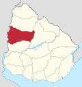 | |
| Sights | ||
This article is issued from Wikipedia - version of the 11/19/2016. The text is available under the Creative Commons Attribution/Share Alike but additional terms may apply for the media files.