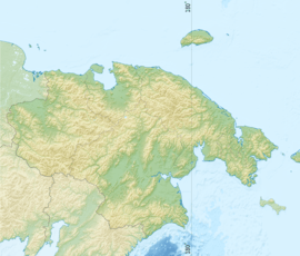
Chaunskaya Bay
| Chaunskaya Bay Чаунская губа | |
|---|---|
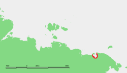
 Location of the bay in Chukotka | |
 | |
| Location | Far North |
| Coordinates | 69°20′58″N 169°46′25″E / 69.3494°N 169.7736°ECoordinates: 69°20′58″N 169°46′25″E / 69.3494°N 169.7736°E |
| River sources | Chaun River, Ichuveyem River, Palyavaam River, Lelyuveyem River, Pucheveyem River |
| Ocean/sea sources | East Siberian Sea |
| Basin countries | Russia |
| Max. length | 140 km (87 mi) |
| Max. width | 110 km (68 mi) |
The Chaunskaya Bay or Chaun Bay (Russian: Чаунская губа) is an Arctic bay in the East Siberian Sea, in the Chaunsky District of Chukotka, northeast Siberia. There is a port at Pevek.
Geography
The bay is open to the north and is 140 km in length. Its maximum width is 110 km.[1] Its mouth is defined by Cape Shelagsky to the east and an unnamed part of Ayon Island to the west. It narrows where the Pevek Peninsula on the east approaches Ayon Island.
Owing to is northerly location Chaunskaya Bay is covered with ice most of the year.
This bay is the center of one of the larger lowlands in Chukotka. A number of rivers flow into the southeastern corner: Chaun River, Ichuveyem River, Palyavaam River, Lelyuveyem River and Pucheveyem River. There is a protected natural area in the southeast. Lake Elgygytgyn is about 160 km southeast and the town of Bilibino about 160 km southwest.
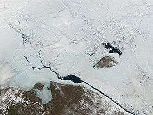 Chaunskaya Bay under ice. Ayon Island and the Pevek Peninsula visible. Wrangle Island to the northeast |
History
The first Russian to reach the area was probably Mikhail Stadukhin in 1649.