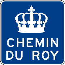
Chemin du Roy
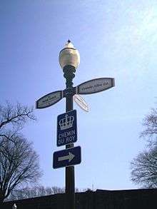
The Chemin du Roy (French for "King's Highway" or "King's Road") is a historic road along the north shore of the St. Lawrence River in Quebec. The road begins in Repentigny and extends almost 280 kilometres (170 mi) eastward towards Quebec City, its eastern terminus. Most of the Chemin du Roy today follows along the present-day Quebec Route 138.
History
In 1706, the Conseil supérieur (Grand Council) of New France decreed that a road be built to connect the settlements along the north shore of the St. Lawrence River. Work began in 1731, under the supervision of Grand Voyer (senior road surveyor) Eustache Lanouiller de Boisclerc, and was completed in 1737. Upon completion, the Chemin du Roy was 7.4 metres (24 ft) wide, over 280 kilometres (170 mi) long, and crossed 37 seignories. The Chemin du Roy was the longest road in existence at the time north of Mexico.
Communities along the Chemin du Roy
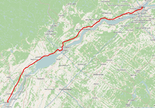
- Repentigny (western terminus)
- Saint-Sulpice
- L'Assomption
- Lavaltrie
- Lanoraie
- Sainte-Geneviève-de-Berthier
- Berthierville
- Saint-Cuthbert
- Saint-Barthélemy
- Maskinongé
- Louiseville
- Yamachiche
- Trois-Rivières
- Champlain
- Batiscan
- Sainte-Anne-de-la-Pérade
- Deschambault-Grondines
- Portneuf
- Cap-Santé
- Donnacona
- Neuville
- Saint-Augustin-de-Desmaures
- Quebec City (eastern terminus)