Chorleywood
| Chorleywood | |
 Chorleywood |
|
| Population | 11,286 (2011 Census)[1] |
|---|---|
| OS grid reference | TQ025965 |
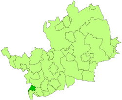
| District | Three Rivers |
| Shire county | Hertfordshire |
| Region | East |
| Country | England |
| Sovereign state | United Kingdom |
| Post town | RICKMANSWORTH |
| Postcode district | WD3 |
| Dialling code | 01923 |
| 01927 | |
| Police | Hertfordshire |
| Fire | Hertfordshire |
| Ambulance | East of England |
| EU Parliament | East of England |
| UK Parliament | Hertfordshire South West |
|
|
Coordinates: 51°39′N 0°31′W / 51.65°N 0.51°W
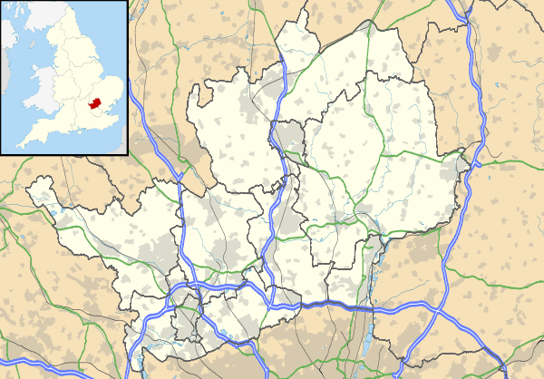
Chorleywood is a village and civil parish in the Three Rivers district of Hertfordshire in the United Kingdom. The parish had a population of 11,286 people at the 2011 census. The village lies in the far south-west of Hertfordshire, on the border with Buckinghamshire. Chorleywood is located 31.8 kilometres (19.8 mi) north-west of Charing Cross in London. It is part of the London commuter belt, and included in the government-defined Greater London Urban Area. Chorleywood is a parish created in 1845 from part of the parish of Rickmansworth.
In a 2004 survey of neighbourhoods carried out by the Office of the Deputy Prime Minister, Chorleywood West was found to be the neighbourhood in England with the highest quality of life. Of the 32,482 neighbourhoods surveyed, Chorleywood West came out top using thirty-seven criteria.[2]
In the early 1960s, researchers at the British Baking Industries Research Association in Chorleywood improved upon an earlier American bread making process. This resulted in the Chorleywood Bread Process, which is now used in over 80% of commercial bread production throughout the UK.[3]
History
Settlement at Chorleywood dates to the Paleolithic era, when the plentiful flint supply led to swift development of tools by early man. The Romans built a small village on the ancient site, complete with a mill and brewery. The likely ruins of a Roman villa are thought to lie under the M25 motorway, which passes through the outskirts of Chorleywood.[4]
A large influx of Saxon settlers in Chorleywood led to it being an important town. The Saxons called it 'Cerola Leah', meaning a meadow in a clearing.[4] Through Chorleywood runs the line that once divided the Kingdoms of Mercia and Wessex and now divides the counties of Hertfordshire and Buckinghamshire. Edward the Confessor gave the town of Chorleywood to the Monastery of St Albans.[4]
By 1278, it was known as 'Bosco de Cherle' or 'Churl's Wood', Norman for 'Peasant's Wood'.[4] Upon the Dissolution of the Monasteries, it passed to the Bishopric of London, being renamed 'Charleywoode'. It became Crown property during the reign of Elizabeth I. The Turnpike Act (1663) gave Chorleywood a chance to exploit its strategic position, allowing locals the opportunity to charge civilians to use the road from Hatfield to Reading.[4]
Chorleywood is most famous for its Quakers. Non-conformists flocked to Chorleywood, promised sanctuary by the locals. William Penn founded the Pennsylvania Colony with settlers from Chorleywood, Rickmansworth, and nearby towns in southern Buckinghamshire, having lived and married in Chorleywood.[4]
With the boom in the paper and printing industries, on which much of south-western Hertfordshire's economy was based in the 19th century, came new prosperity. The extension of the Metropolitan Railway to Chorleywood on 8 July 1889 brought with it population growth, which continued until the 1960s. From a population of 1,500 people in 1897, the population has grown to over 11,000 today.
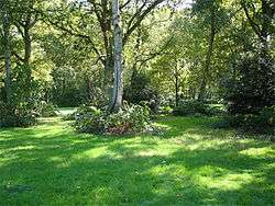
A Regency mansion called Chorleywood House was built here in 1822 by John Barnes, replacing an earlier farm house. John Saunders Gilliat, who was Governor of the Bank of England in 1883-1885, lived in this house. In 1892, the house was bought by Lady Ela Sackville Russell, eldest daughter of the 9th Duke of Bedford. She modified and enlarged the house, turning the grounds into a model estate with market gardens.
When the Local Government Act 1894 created districts as subdivisions of the newly created county councils, Chorleywood became part of the Watford Rural District, which encircled Watford. In 1913, the town was separated from Watford Rural District to become Chorleywood Urban District, formalising its current name. In the BBC TV documentary Metro-land (1973), Sir John Betjeman described Chorleywood as "essential Metro-land".[5] In 1974, the Urban District, along with Rickmansworth Urban District and most of Watford Rural District were merged to form the Three Rivers non-metropolitan district.
Geography
Chorleywood Common
Chorleywood Common is a tract of 0.8 square kilometres (200 acres) of wooded common land. The common is a County Heritage Site, with significant biodiversity. Since cattle grazing ended soon after the First World War, the land has been used for recreational purposes. Chorleywood Golf Club maintains a nine-hole golf course on the Common. In the 19th century, the MCC established a cricket pitch on the Common, which is used by Chorleywood Cricket Club's senior and junior teams to this day.
Next to the common is an Anglican church and primary school, both called Christ Church.
Three Rivers District Council are currently proposing the reintroduction of grazing on the Common, which would mean the partial enclosure, or fencing off, of sections of the common.
The grounds of Chorleywood House now form a 170-acre (0.69 km2) public park.[6]
Politics
The parish of Chorleywood covers the village of Chorleywood, as well as Loudwater and the north-western parts of Rickmansworth. Chorleywood Parish Council is controlled by the Liberal Democrats, with ten councillors to the Conservative Party's seven.
At a district level, Chorleywood is part of Three Rivers. It lies across two wards - Chorleywood North & Sarratt and Chorleywood South & Maple Cross. The two are divided by the Metropolitan line railway; Chorleywood South & Maple Cross includes most of Chorleywood village and Maple Cross, while Chorleywood North & Sarratt covering the north of Chorleywood village, Loudwater, Sarratt, and Belsize. On Three Rivers District Council - which is controlled overall by the Liberal Democrats - Chorleywood North & Sarratt is represented by three Conservative councillors (Marilyn Butler, Alex Hayward, and Heather Kenison), whilst Chorleywood South & Maple Cross is represented by three Liberal Democrat councillors (Ann Shaw, Sue Stibbs, and Martin Trevett).
At a county level, Chorleywood is part of Hertfordshire. At the County Council, a larger Chorleywood constituency, including the parish of Chorleywood, but also all of Sarratt parish and part of the parish of Abbots Langley, is represented by Chris Hayward of the Conservatives.
Chorleywood is a part of the parliamentary constituency of Hertfordshire South West, which is represented in the House of Commons by Chorleywood resident David Gauke of the Conservatives.[7]
Demography
At the 2011 census, the parish of Chorleywood had a resident population of 11,286, of whom:
| Chorleywood (parish) |
Three Rivers | England & Wales | |
|---|---|---|---|
| Age[8] | |||
| Median age | 44 | 41 | 39 |
| Under 18 | 23.8% | 22.7% | 21.3% |
| Over 65 | 20.5% | 16.8% | 16.4% |
| Ethnic group[9] | |||
| White British | 79.6% | 79.7% | 80.5% |
| White Other | 6.0% | 6.6% | 5.5% |
| Indian or British Indian | 7.9% | 6.0% | 2.5% |
| Other Asian or British Asian | 3.1% | 3.2% | 5.0% |
| Black or Black British | 0.7% | 1.8% | 3.3% |
| Other ethnic group | 0.4% | 0.5% | 1.0% |
| Religion[10] | |||
| Christian | 59.3% | 59.9% | 59.3% |
| Hindu | 5.8% | 4.5% | 1.5% |
| Jewish | 2.8% | 1.8% | 0.5% |
| Muslim | 2.1% | 2.2% | 4.8% |
| Another religion | 1.7% | 1.6% | 1.6% |
| No religion | 20.9% | 22.8% | 25.1% |
| Did not answer | 7.5% | 7.0% | 7.2% |
Transport
The town has grown remarkably in the past century, thanks primarily to the extension of the Metropolitan line of the London Underground, which reached Chorleywood in 1889. Junction 18 of the M25 motorway, with the A404, is at Chorleywood.
Chorleywood station is in Zone 7 on the Metropolitan line, situated between Chalfont and Latimer and Rickmansworth. The majority of trains passing through Chorleywood are operated by London Underground, but the station is also a stop for Chiltern Railways services running between Marylebone and Aylesbury stations.
Schools
- St Clement Danes School, a mixed academy school
Twin town
Footnotes
- ↑ "Civil Parish population 2011". Neighbourhood Statistics. Office for National Statistics. Retrieved 28 October 2016.
- ↑ "Suburbs score in quality of life". BBC News. 6 May 2004. Retrieved 10 September 2006.
- ↑ "The Chorleywood Bread Process, Training course, Campden and Chorleywood Food Research Association (CCFRA)".
- 1 2 3 4 5 6 "Local History". Chorleywood Parish Council. Retrieved 11 June 2008.
- ↑ Davidson, Max (5 June 2002). "End of the line for a poet's scorn". The Daily Telegraph. London. Retrieved 11 June 2008.
- ↑ "Welcome Chorleywood House Estate". Official website. Chorleywood House Estate. 2010. Retrieved 22 March 2010.
- ↑ "David Gauke MP". Conservative Party. Retrieved 10 June 2008.
- ↑ "Age structure". United Kingdom Census 2011. Office for National Statistics. 12 February 2013.
- ↑ "Ethnic group". United Kingdom Census 2011. Office for National Statistics. 30 January 2013.
- ↑ "Religion". United Kingdom Census 2011. Office for National Statistics. 30 January 2013.
External links
- https://whatsonchorleywood.wordpress.com/
- http://www.facebook.com/Whats-On-Chorleywood-339437383071145/?fref=ts
- http://www.chorleywoodnet.co.uk/
- http://www.chorleywood-pc.gov.uk/