Chott el Djerid
| Chott el Djerid | |
|---|---|
 | |
| Coordinates | 33°42′N 8°26′E / 33.7°N 8.43°ECoordinates: 33°42′N 8°26′E / 33.7°N 8.43°E |
| Type | Salt lake, endorheic basin |
| Primary inflows | groundwater |
| Primary outflows | terminal Evaporation |
| Basin countries | Tunisia |
| Max. length | 250 km (160 mi) |
| Max. width | 20 km (12 mi) |
| Surface area | 7,000 km2 (2,700 sq mi) |
| Surface elevation | +10-25 m |
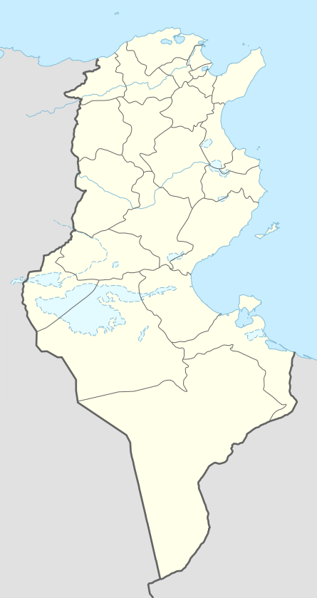
Chott el Djerid (Arabic: شط الجريد Šoṭṭ el-Jarīd) also spelled Sciott Gerid and Shott el Jerid,[1][2][3][4] is a large endorheic salt lake in southern Tunisia.
Geography
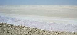
The bottom of Chott el Djerid is located between 10 and 25 meters below sea level.[5] Roughly in the shape of a wolf, with a width of 20 km (12 mi) at its narrowest point, it reaches 250 km (160 mi) in overall length. At times, parts of it appear in various shades of white, green and purple.[6] The narrow eastward inlet of the chott is also known as Chott el Fejej.
It is the largest salt pan of the Sahara Desert with a surface area of over 7,000 km2 (some sources state 5,000 km2). The site has a typical hot desert climate. Due to the harsh climate with mean annual rainfall of below 100 mm and daytime temperatures sometimes reaching 50 °C or more during summer with dense solar radiation, water evaporates from the lake. In summer Chott el Djerid is almost entirely dried up, and numerous fata morganas occur.
During winter, a small tributary of water can be seen discharging into the lake.[7]
Surrounding area
South of Chott el Djerid, the Grand Erg Oriental desert begins. The towns of Kebili and Douz are also located south of the lake.
Access
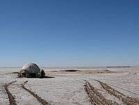
The lake can be crossed by foot and even by car, but this is very dangerous since the salt crust is not always firm.
During winter, when the lake is full, it can be crossed by boat. Piles of salt at its edges are collected for salt production processing.[6]
Fauna
Relict populations of the West African crocodile persisted in the Chott el Djerid until the early 20th century.[8]
Namesakes
Chott el Djerid is the namesake of the Jerid Lacuna an Endorheic hydrocarbon lake on the Saturnian moon Titan. That lake is located 66.7°N and 221°W on Titan's globe and involves liquid methane and ethane,[9] instead of water.
In popular culture
Chott el Djerid was used as a filming location for the Star Wars series,[10] among others. It was also described in Jules Verne's last novel, Invasion of the Sea.
See also
References
- ↑ "Shaţţ al Jarīd: Tunisia". Geographical Names. Retrieved 2011-05-23.
- ↑ "Sciott Gerid: Tunisia". Geographical Names. Retrieved 2011-05-23.
- ↑ "Chott el Jerid: Tunisia". Geographical Names. Retrieved 2011-05-23.
- ↑ "Shott el Jerid: Tunisia". Geographical Names. Retrieved 2011-05-23.
- ↑ "Flood Maps". NASA et al. Retrieved 2011-08-20.
- 1 2 "البحيرة شط ايل الجريد - تونس". Tixik.com. Retrieved 2011-05-23.
- ↑ "شـط الجـريد". Al-hakawati. Retrieved 2011-05-23.
- ↑ "Crocodiles in the Sahara Desert: An Update of Distribution, Habitats and Population Status for Conservation Planning in Mauritania". PLOS ONE. February 25, 2011.
- ↑ Coustenis, A.; Taylor, F. W. (21 July 2008). Titan: Exploring an Earthlike World. World Scientific. pp. 154–155. ISBN 978-981-281-161-5.
- ↑ "Star Wars Episode IV: A New Hope film locations". The Worldwide Guide to Movie Locations: Exploring film locations around the world. www.movie-locations.com. Retrieved 2011-05-23.
External links
| Wikimedia Commons has media related to Chott el Djerid. |