Pic de Finestrelles
| Pic de Finestrelles | |
|---|---|
 | |
| Highest point | |
| Elevation | 2,826 m (9,272 ft) |
| Coordinates | 42°24′52.03″N 2°08′0.726″E / 42.4144528°N 2.13353500°ECoordinates: 42°24′52.03″N 2°08′0.726″E / 42.4144528°N 2.13353500°E |
| Geography | |
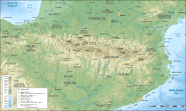 Pic de Finestrelles Pyrenees | |
| Location |
Queralbs (Ripollès) Eina and Llo (Alta Cerdanya), Catalonia |
| Parent range | Pyrenees |
| Climbing | |
| First ascent | Unknown |
| Easiest route | From Ulldeter or Vall de Núria |
Pic de Finestrelles is a mountain of Catalonia. Located in the Pyrenees, in the area bordering France and Spain, it has an altitude of 2,826 metres (9,272 ft) above sea level.[1]
See also
References
- ↑ "Mapa Topogràfic de Catalunya". Institut Cartogràfic de Catalunya. Retrieved May 22, 2010..
This article is issued from Wikipedia - version of the 12/6/2015. The text is available under the Creative Commons Attribution/Share Alike but additional terms may apply for the media files.