Coleen River
| Coleen River | |
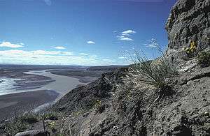 Coleen River in summer | |
| Country | United States |
|---|---|
| State | Alaska |
| Districts | North Slope Borough, Yukon–Koyukuk Census Area |
| Source | Brooks Range |
| - location | Arctic National Wildlife Refuge, North Slope Borough |
| - elevation | 4,798 ft (1,462 m) [1] |
| - coordinates | 68°42′59″N 143°28′36″W / 68.71639°N 143.47667°W [2] |
| Mouth | Porcupine River [2] |
| - location | 9 miles (14 km) east of Coleen Mountain, Yukon–Koyukuk Census Area |
| - coordinates | 67°04′20″N 142°29′49″W / 67.07222°N 142.49694°WCoordinates: 67°04′20″N 142°29′49″W / 67.07222°N 142.49694°W [2] |
| Length | 52 mi (84 km) [2] |
 Location of the mouth of the Coleen River in Alaska
| |
The Coleen River is a 52-mile (84 km) tributary of the Porcupine River in the northeastern part of the U.S. state of Alaska.[2] It begins in the Davidson Mountains in the Arctic National Wildlife Refuge and flows generally south-southeast into the larger river east of Coleen Mountain.[3] Its name comes from the French "coline", which means hill.
See also
References
- ↑ Derived by entering source coordinates in Google Earth.
- 1 2 3 4 5 "Coleen River". Geographic Names Information System. United States Geological Survey. March 31, 1981. Retrieved November 6, 2013.
- ↑ Alaska Atlas & Gazetteer (7th ed.). Yarmouth, Maine: DeLorme. 2010. p. 137. ISBN 978-0-89933-289-5.
External links
- "Coleen River Watershed -- 19040202". cfpub.epa.gov. Retrieved 2009-11-29.
This article is issued from Wikipedia - version of the 9/10/2016. The text is available under the Creative Commons Attribution/Share Alike but additional terms may apply for the media files.