Colorado State Highway 53
| ||||
|---|---|---|---|---|
| Broadway Street | ||||
|
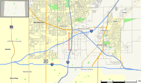
Map of Adams County in north central Colorado with SH 53 highlighted in red | ||||
| Route information | ||||
| Maintained by CDOT | ||||
| Length: | 1.663 mi[1] (2.676 km) | |||
| Major junctions | ||||
| South end: |
| |||
| North end: |
| |||
| Location | ||||
| Counties: | Adams | |||
| Highway system | ||||
|
Colorado State Highways
| ||||

State Highway 53 (SH 53) is a state highway in Adams County, Colorado, United States, north of Denver. It connects Interstate 25 with State Highway 224 along Broadway Street.
Route description
SH 53 begins at the 58th Avenue interchange (exit 215) on I-25. After a short distance west on 58th Avenue, the route turns north on Broadway Street, crossing under Interstate 76 with no access and ending at 70th Avenue (SH 224).[2][1]
History
In 1971-1972, Colorado constructed an extension of Broadway Street from 66th Avenue north to SH 224, including a bridge over Clear Creek. Along with existing portions of Broadway Street and 58th Avenue, the new roadway was designated State Highway 53.[3][4][5]
Major intersections
The entire route is in Adams County.
| Location | mi | km | Destinations | Notes | |
|---|---|---|---|---|---|
| | 0.000 | 0.000 | |||
| | 0.238 | 0.383 | Broadway Street / East 58th Avenue | SH 53 turns from East 58th Avenue onto Broadway Street | |
| | 1.663 | 2.676 | |||
| 1.000 mi = 1.609 km; 1.000 km = 0.621 mi | |||||
References
- 1 2 Colorado Department of Transportation, Highway Data Explorer, accessed November 2013
- ↑ Google Maps including Street View photographs, accessed November 2013
- ↑ Colorado Department of Transportation, official highway maps: 1971, 1972
- ↑ United States Geological Survey, Commerce City 1:24000, 1969
- ↑ United States Geological Survey, Commerce City 1:24000, 1973
External links
This article is issued from Wikipedia - version of the 2/5/2016. The text is available under the Creative Commons Attribution/Share Alike but additional terms may apply for the media files.