Colorado State Highway 78
| ||||
|---|---|---|---|---|
|
Map of south central Colorado with SH 78 highlighted in red | ||||
| Route information | ||||
| Maintained by CDOT | ||||
| Length: | 33.272 mi[1] (53.546 km) | |||
| Location | ||||
| Counties: | Custer, Pueblo | |||
| Highway system | ||||
|
Colorado State Highways
| ||||

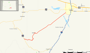
State Highway 78 is a highway connecting Pueblo to the town of Beulah and the San Isabel National Forest.
Route description
SH 78 runs 33.2 miles (53.4 km), starting at a junction with State Highway 165 in San Isabel National Forest and ending at a junction with State Highway 45 in Pueblo. A short spur route, also marked as SH 78 runs 1.5 miles (2.4 km) from the main highway, ending at the intersection of Grand and Pennsylvania avenues in Beulah.
Major intersections
| County | Location | mi | km | Destinations | Notes |
|---|---|---|---|---|---|
| Custer | | 0.000 | 0.000 | ||
| Pueblo | Beulah | 12.710 | 20.455 | Beulah Spur | |
| Pueblo | 33.273 | 53.548 | |||
| 1.000 mi = 1.609 km; 1.000 km = 0.621 mi | |||||
References
- ↑ "Segment list for SH 78". Retrieved 2011-01-21.
External links
This article is issued from Wikipedia - version of the 11/6/2016. The text is available under the Creative Commons Attribution/Share Alike but additional terms may apply for the media files.