Conception Island, Seychelles
Not to be confused with Conception Island, Bahamas.
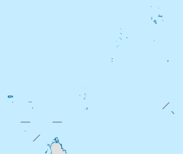 Conception Island Location of Conception Island in Seychelles | |
| Geography | |
|---|---|
| Location | Seychelles, Indian Ocean |
| Coordinates | 4°40′S 55°22′E / 4.667°S 55.367°ECoordinates: 4°40′S 55°22′E / 4.667°S 55.367°E |
| Archipelago | Inner Islands, Seychelles |
| Adjacent bodies of water | Indian Ocean |
| Total islands | 1 |
| Major islands |
|
| Area | 0.604 km2 (0.233 sq mi) |
| Length | 1.5 km (0.93 mi) |
| Width | 0.6 km (0.37 mi) |
| Coastline | 35 km (21.7 mi) |
| Highest elevation | 131 m (430 ft) |
| Highest point | Conception |
| Administration | |
| Group | Granitic Seychelles |
| Sub-Group | Mahe Islands |
| Sub-Group | Port Glaud Islands |
| Districts | Port Glaud |
| Demographics | |
| Demonym | Creole |
| Population | 0 (2014) |
| Pop. density | 0 /km2 (0 /sq mi) |
| Ethnic groups | Creole, French, East Africans, Indians. |
| Additional information | |
| Time zone | |
| Official website |
www |
| ISO Code = SC-21 | |
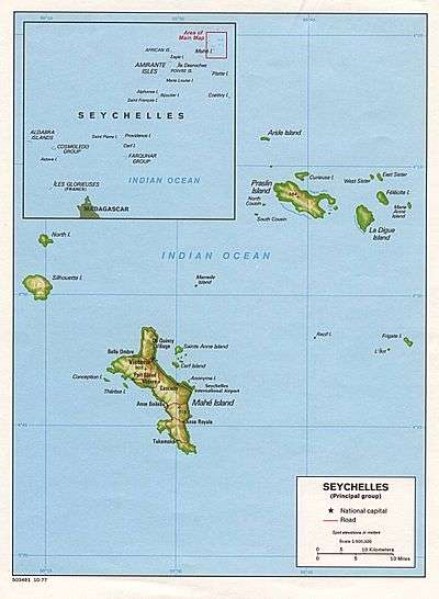
Conception Island is a small island (.603 km2) in the Seychelles 2 km west of Mahé. Conception contained a coconut plantation until the mid-1970s; today it is uninhabited. Conception Island, along with its sister island Thérèse Island, is part of Port Glaud district of Mahé, the main island of the Seychelles.
Recently the island has been created as a wildlife reserve. It is the home of the extremely rare Seychelles white-eye and other birds such as the Seychelles kestrel, Seychelles blue pigeon and the Madagascar turtle-dove. It also has two species of gecko.[1]
Image gallery
 Map 1
Map 1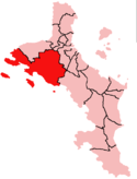 District Map
External links
- Official Conception Island Guide
- National Bureau of Statistics
- info
- Mahe Map 2015
- Info on the island
References
| Wikimedia Commons has media related to Conception Island. |
This article is issued from Wikipedia - version of the 11/29/2016. The text is available under the Creative Commons Attribution/Share Alike but additional terms may apply for the media files.