Cordova, Illinois
| Cordova | |
| Village | |
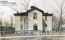 Old Cordova School | |
| Country | United States |
|---|---|
| State | Illinois |
| County | Rock Island |
| Coordinates | 41°40′39″N 90°19′15″W / 41.67750°N 90.32083°WCoordinates: 41°40′39″N 90°19′15″W / 41.67750°N 90.32083°W |
| Area | 0.60 sq mi (2 km2) |
| - land | 0.60 sq mi (2 km2) |
| - water | 0.00 sq mi (0 km2) |
| Population | 633 (2000) |
| Density | 1,125.9/sq mi (435/km2) |
| Timezone | CST (UTC−6) |
| - summer (DST) | CDT (UTC−5) |
| Postal code | 61242 |
| Area code | 309 |
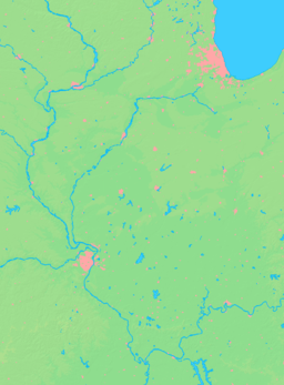  Location of Cordova within Illinois
| |
| Wikimedia Commons: Cordova, Illinois | |
Cordova is a village in Rock Island County, Illinois, United States. The population was 672 at the 2010 census, up from 633 in 2000.
Geography
Cordova is located at 41°40′39″N 90°19′15″W / 41.67750°N 90.32083°W (41.677423, -90.320704).[1]
According to the 2010 census, Cordova has a total area of 0.6 square miles (1.55 km2), all land.[2]
Power plant
The city is home to one of three nuclear power plants in the west central Illinois area.[3]
Demographics
| Historical population | |||
|---|---|---|---|
| Census | Pop. | %± | |
| 1880 | 447 | — | |
| 1890 | 443 | −0.9% | |
| 1900 | 414 | −6.5% | |
| 1910 | 324 | −21.7% | |
| 1920 | 271 | −16.4% | |
| 1930 | 271 | 0.0% | |
| 1940 | 364 | 34.3% | |
| 1950 | 475 | 30.5% | |
| 1960 | 502 | 5.7% | |
| 1970 | 589 | 17.3% | |
| 1980 | 697 | 18.3% | |
| 1990 | 638 | −8.5% | |
| 2000 | 633 | −0.8% | |
| 2010 | 672 | 6.2% | |
| Est. 2015 | 660 | [4] | −1.8% |
As of the census[6] of 2000, there were 633 people, 245 households, and 179 families residing in the village. The population density was 1,125.9 people per square mile (436.4/km²). There were 266 housing units at an average density of 473.1 per square mile (183.4/km²). The racial makeup of the village was 96.37% White, 0.16% African American, 0.16% Asian, 0.32% Pacific Islander, 1.58% from other races, and 1.42% from two or more races. Hispanic or Latino of any race were 2.53% of the population.
There were 245 households out of which 31.4% had children under the age of 18 living with them, 62.9% were married couples living together, 4.9% had a female householder with no husband present, and 26.9% were non-families. 24.5% of all households were made up of individuals and 13.1% had someone living alone who was 65 years of age or older. The average household size was 2.57 and the average family size was 3.00.
In the village the age distribution of the population shows 25.9% under the age of 18, 6.5% from 18 to 24, 27.6% from 25 to 44, 25.9% from 45 to 64, and 14.1% who were 65 years of age or older. The median age was 40 years. For every 100 females there were 104.9 males. For every 100 females age 18 and over, there were 98.7 males.
The median income for a household in the village was $50,000, and the median income for a family was $59,063. Males had a median income of $45,179 versus $25,000 for females. The per capita income for the village was $21,442. About 4.2% of families and 6.2% of the population were below the poverty line, including 1.4% of those under age 18 and 20.5% of those age 65 or over.
Notable person
- Len Stockwell, outfielder for the Cleveland Blues, Louisville Eclipse and Cleveland Spiders; born in Cordova
References
- ↑ "US Gazetteer files: 2010, 2000, and 1990". United States Census Bureau. 2011-02-12. Retrieved 2011-04-23.
- ↑ "G001 - Geographic Identifiers - 2010 Census Summary File 1". United States Census Bureau. Retrieved 2015-08-02.
- ↑ "EIA - State Nuclear Profiles". eia.gov. Retrieved 4 January 2016.
- ↑ "Annual Estimates of the Resident Population for Incorporated Places: April 1, 2010 to July 1, 2015". Retrieved July 2, 2016.
- ↑ "Census of Population and Housing". Census.gov. Archived from the original on May 11, 2015. Retrieved June 4, 2015.
- ↑ "American FactFinder". United States Census Bureau. Archived from the original on 2013-09-11. Retrieved 2008-01-31.
Municipalities and communities of Rock Island County, Illinois, United States | ||
|---|---|---|
| Cities | ||
| Villages | ||
| Townships | ||
| CDPs | ||
| Other unincorporated communities |
| |
| Footnotes | ‡This populated place also has portions in an adjacent county or counties | |