Coronel Fabriciano
| Coronel Fabriciano | |||
|---|---|---|---|
| Municipality | |||
| The Municipality of Coronel Fabriciano | |||
|
Coronel Fabriciano | |||
| |||
|
Nickname(s): "Fabri" "Fabriciano" "Coração do Vale" "Terra mãe do Vale do Aço" | |||
|
Motto: Deus, Pax Et Prosperitas, Deus, Paz e Prosperidade God, Pax Et Prosperitas, God, Peace and Prosperity) | |||
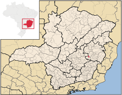 | |||
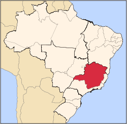
 Coronel Fabriciano Location in Brazil | |||
| Coordinates: BR 19°31′08″S 42°37′44″W / 19.51889°S 42.62889°WCoordinates: BR 19°31′08″S 42°37′44″W / 19.51889°S 42.62889°W | |||
| Country |
| ||
| Region | Southeast | ||
| State | Minas Gerais | ||
| Mesoregion | Vale do Rio Doce | ||
| Demonym | fabricianense | ||
| Founded | January 20, 1949 | ||
| Government | |||
| • Mayor | Francisco Simões (PT) | ||
| Area | |||
| • Total | 221.049 km2 (85.347 sq mi) | ||
| Elevation | 250 m (820 ft) | ||
| Population (2013) | |||
| • Total | 108,302 | ||
| • Density | 489.95/km2 (1,269.0/sq mi) | ||
| Time zone | UTC-3 (UTC-3) | ||
| Postal Code | 35170-000 | ||
| HDI (2000) | 0.789 – medium | ||
| Website |
www | ||


Coronel Fabriciano is a municipality in the state of Minas Gerais in the Southeast region of Brazil.[1] It is located in the mesoregion of the Vale do Rio Doce and microregion of Ipatinga and is situated 200 km from the capital. The municipal population was estimated in 2012 by IBGE in 104,637 inhabitants, thus the 27th most populous in the Minas Gerais state.[2] The area is 221.049 km² (13.1549 km² of urban area).[3][4]
The municipality was emancipated from Antônio Dias in 1948 and it name is a tribute to Lieutenant colonel Fabriciano Felisberto Carvalho de Brito.[5] The town was situated in the Vale do Aço (Steel Valley) metropolitan area, between the largest steel industries of Minas Gerais state; the Usiminas, in Ipatinga, and the Aperam South America, in Timóteo. These industries, when they were installed, were situated in Fabriciano and were essential to the development of the city. But with the emancipation of Ipatinga and Timóteo, occurred in 1964, the companies now belong to these cities.[6]
Coronel Fabriciano is located in the Serra dos Cocais, home of many natural attractions of the city like the "Pedra Dois Irmãos" (Two Brothers stone), the "Pedra do Caladão" (Caladão stone), the "Cachoeira do Escorregador" (slide waterfalls), the "Trilhas da Mamucha" (Mamucha trails), and other waterfalls and trails. Still there is the practice of sports like trail, trekking, mountain biking, parachute jump and 4x4 trails. In the city are also located several historical monuments like the "Catedral de São Sebastião" (Saint Sebastian Cathedral), the "Colégio Angélica" (Angélica College) and the "Monumento Terra Mãe" (motherland monument).[7][8]
The Human Development Index (HDI) is 0.789, classified as medium by the United Nations Development Programme (UNDP).[9]
History
With the inauguration of the Calado Station, they began to be lifted up the first homes, very poor and basic. Only in 1928 was built, with the exception of the train station, the first house covered with ceramic and floored.
By the Law State no. 843, of November 17 of 1926, the district was created, settling the May 7 of 1927 in the then patrimony of Santo Antônio, that passed to Melo Viana to be called, having been named his/her first peace judge the citizen Manoel Camilo of Fonseca, that gave ownership to his/her first peace clerk, Mr. João the Baptist Pereira. The first registrations civil facts were: the twins' baptism Duraci of Distaneta, daughters of the couple Antônio Viana and the marriage of the Sírio Maron Abibi with Geralda Honrata of Souza. On March 1 of 1930, it was accomplished in the new district the first election
The first name of the place when virgin forest, was Barra, for finding located in the confluence of the ribeirão Caladão, starting to denominate Calado (Quiet), with the inauguration of the Rail Station. Almost time, Raul Soares was denominated, returning the Calado (Quiet) name again. In August 1938, it was baptized with Coronel Fabriciano Fabriciano name, in honor to colonel Fabriciano Felisberto of I Break, for occasion of his/her centennial from birth. Ten years later, the municipal district was created being dismembered of Antônio Dias.
On December 27 of 1948, after a long process gone through the procedure in the Legislative Assembly of the State, governor Milton Campos signs the Law no. 336, creating the municipal district of Coronel Fabriciano. The official installation felt in the day January 1 of 1949, in session presided by the peace judge José Anastácio Franco. It assumed as manager Dr. Antônio Gonçalves Gravatá, with the different objective of to organize the municipal administration and to give him/it to the official mayor, elect for the population. It is like this, the March 15 of 1949, they take ownership then the mayor Dr. Rubem Siqueira Maia, vice-mayor Colonel Silvino Pereira, aldermen Nicanor Ataíde, Lauro Pereira, Ary Barros, José Anatólio Barbosa, Wenceslau Martins Araújo, Sebastião Mendes Araújo, José Paula Viana, Raimundo Martins Fraga and José Wilson Camargo.
In spite of the emancipation and December 27 of 1948, an agreement was signed with the local parish, in which the birthday of the city is commemorated on January 20, day of the patron of the city, São Sebastião.
Geography


Statistics
- Elevation: 240 mts.
- Climate: Sub-tropical.
- Average annual temperature: 22 °C
- Latitude South 19°31'07"
- Longitude West: 42°37'44
Subdivisions
Main streets and avenues
Most of the city's main avenues (Avenidas) and streets (Ruas) are named after important people. Some of them are in blue below, linked to their Wikipedia article.
- Avenida Julita Pires Bretas
- Avenida José de Magalhães Pinto
- Avenida Geraldo Inácio
- Avenida Tancredo de Almeida Neves
- Avenida Rubens Siqueira Maia
- Rua Maria Matos
- Rua Pedro Nolasco
- Rua Moacir Birro
- Rua Marechal Floriano
- Rua São Sebastião
- Rua Argemiro José Ribeiro
- Rua Padre Américo Magalhães
Districts
- Senador Melo Viana
- Coronel Fabriciano (sede)
Neighborhoods
Distances from other cities (KM)
- Belo Horizonte: 198
- Rio de Janeiro: 560
- São Paulo: 765
- Vitória: 420
- Brasília: 936
- Ipatinga: 13
- Timóteo: 6
- Governador Valadares: 118
- Sete Lagoas: 273
Economy
The city is between Ipatinga and Timóteo, that base the largest and more modern siderurgic industries of Minas Gerais: Usiminas and Arcelor Mittal Timóteo, respectively. Coronel Fabriciano, those cities and several others, are in the Metropolitan Area of Vale do Aço, where Fabriciano is the second largest city, and has the third GDP.
Trading, services, eucalyptus monoculture, small and medium industries are the main activities in Coronel Fabriciano.
Commercial
According to official statistics of the city hall (http://www.fabriciano.mg.gov.br), the commercial activities include 3.561 registered establishments, of the most varied branches. The section of services involves 3.275 names registered, with prominence for the branch of Hostelry: there are about 1.800 accommodations, and 400 of them are framed in the categories "three" or "four stars."
Agriculture
Eucalyptus, from rural areas, is used by Cenibra, a Brazilian-Japanese cellulose factory in Belo Oriente. It is also used by local charcoal factories.
Industry
Several factories are based in the city, many of then in the Industrial District.
Sports
Extreme
The mountains of Serra dos Cocais in Fabriciano is usually used for extreme sports. Motorcycles and bikes are often used. But it's also common to make slow rides by foot or by horse in these calm mountains and see the waterfalls.
Auto racing
The city's Jeep Club, Jipe Clube Vale do Aço, often organize jeep travels and competitions. In 2008, Fabriciano hosted the 3rd race of the state's 4x4 Regularity rally Championiship.
Football
The city main professional football club is Social that plays the state's first division
Images
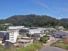
-

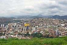
Partial view of the downtown and the Morro do Carmo.
-
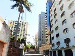
Buildings in the city.
-
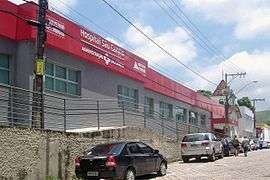
São Camilo Hospital.
-

"Terra Mãe" Monument.
-

Estação Square.
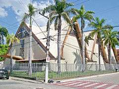
-

Saint Sebastian Matriz Church.
-

Colégio Angélica, a school founded in 1950.
-

Magalhães Pinto Avenue.
-

Tancredo Neves Avenue.
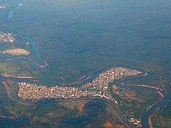
-

Downtown Fabriciano, with neighbour city Timóteo visible in the horizon.
-

Mountains of the Serra dos Cocais.
-
Saint Sebastian Cathedral.
-
Industrial District.
-

City Hall.
-

Pedro Nolasco Street.
-

JK Square.
-

Partial view.
-

Region of the Caladinho neighbourhood.
-
Amaro Lanari neighbourhood.
-
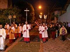
Corpus Christi procession of the Saint Sebastian Parish.


See also
References
- ↑ Instituto Brasileiro de Geografia e Estatística (IBGE) (December 19, 2007). "Produto Interno Bruto dos Municípios 2002-2005" (PDF) (in Portuguese). Archived from the original (PDF) on October 2, 2008. Retrieved February 25, 2013.
- ↑ Instituto Brasileiro de Geografia e Estatística (August 31, 2012). "Estimativas da população residente nos municípios brasileiros com data referência em 1º de julho de 2012" (PDF) (in Portuguese). Retrieved February 25, 2013.
- ↑ Divisão Territorial do Brasil e Limites Territoriais, Instituto Brasileiro de Geografia e Estatística (IBGE) (July 1, 2008). "Divisão Territorial do Brasil" (in Portuguese). Retrieved February 25, 2013.
- ↑ Embrapa Monitoramento por Satélite. "Minas Gerais" (in Portuguese). Retrieved February 25, 2013.
- ↑ Revista Caminhos Gerais, number 18, page 7
- ↑ Prefeitura (June 3, 2009). "A criação do município" (in Portuguese). Retrieved February 25, 2013.
- ↑ Prefeitura (March 1, 2012). "Patrimônio Cultural" (in Portuguese). Retrieved February 25, 2013.
- ↑ Prefeitura (August 7, 2009). "Sugestão de passeios: roteiro para o meio urbano" (in Portuguese). Retrieved February 25, 2013.
- ↑ Atlas do Desenvolvimento Humano, Programa das Nações Unidas para o Desenvolvimento (PNUD) (2000). "Ranking decrescente do IDH-M dos municípios do Brasil" (in Portuguese). Archived from the original on October 3, 2009. Retrieved February 25, 2013.
External links
Capital: Belo Horizonte | |||||||||||||||||||||||||||||||||||||||||||||
|  | ||||||||||||||||||||||||||||||||||||||||||||
|
| |||||||||||||||||||||||||||||||||||||||||||||
| |||||||||||||||||||||||||||||||||||||||||||||
| |||||||||||||||||||||||||||||||||||||||||||||
| |||||||||||||||||||||||||||||||||||||||||||||
| |||||||||||||||||||||||||||||||||||||||||||||
| |||||||||||||||||||||||||||||||||||||||||||||
| |||||||||||||||||||||||||||||||||||||||||||||
| |||||||||||||||||||||||||||||||||||||||||||||
| |||||||||||||||||||||||||||||||||||||||||||||
| |||||||||||||||||||||||||||||||||||||||||||||