Crasville, Manche
| Crasville | |
|---|---|
|
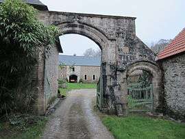
Grenneville Pavilion | |
 Crasville | |
|
Location within Normandy region  Crasville | |
| Coordinates: 49°33′10″N 1°20′17″W / 49.5528°N 1.3381°WCoordinates: 49°33′10″N 1°20′17″W / 49.5528°N 1.3381°W | |
| Country | France |
| Region | Normandy |
| Department | Manche |
| Arrondissement | Cherbourg-Octeville |
| Canton | Quettehou |
| Intercommunality | Communauté de communes du Val de Saire |
| Government | |
| • Mayor (2008–2014) | Jacqueline Hubert |
| Area1 | 7.18 km2 (2.77 sq mi) |
| Population (2006)2 | 243 |
| • Density | 34/km2 (88/sq mi) |
| Time zone | CET (UTC+1) |
| • Summer (DST) | CEST (UTC+2) |
| INSEE/Postal code | 50150 / 50630 |
| Elevation |
2–87 m (6.6–285.4 ft) (avg. 49 m or 161 ft) |
|
1 French Land Register data, which excludes lakes, ponds, glaciers > 1 km² (0.386 sq mi or 247 acres) and river estuaries. 2 Population without double counting: residents of multiple communes (e.g., students and military personnel) only counted once. | |
Crasville is a commune in the Manche department in Normandy in north-western France.
See also
| Wikimedia Commons has media related to Crasville (Manche). |
This article is issued from Wikipedia - version of the 8/16/2016. The text is available under the Creative Commons Attribution/Share Alike but additional terms may apply for the media files.