Crawfish River
The Crawfish River is a tributary of the Rock River, 80 miles (130 km) long,[1] in south-central Wisconsin in the United States. Via the Rock River, it is part of the watershed of the Mississippi River.
The United States Board on Geographic Names named the stream Crawfish River in 1987.
Course

The Crawfish River rises in Columbia County and initially flows generally eastwardly in a broadly meandering course, collecting the North Fork Crawfish River (which also rises in Columbia County and passes through the village of Fall River) and passing the city of Columbus. In Dodge County the river turns southward and collects two tributaries, the Maunesha River and the Beaver Dam River, before entering Jefferson County, where it joins the Rock River at the city of Jefferson. Aztalan State Park is located along the river in Jefferson County at the site of a 10th - 13th Century Native American settlement.
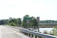
Shortly before merging the Rock and Crawfish rivers cross under Interstate 94. Both rivers flood the nearby land on an annual basis. In 2008, some lanes on I-94 were temporarily closed due to the flooding from both rivers.[2]
See also
References
- ↑ U.S. Geological Survey. National Hydrography Dataset high-resolution flowline data. The National Map Archived 2012-04-05 at WebCite, accessed May 13, 2011
- ↑ 2008 flood
- Columbia Gazetteer of North America entry
- DeLorme (1992). Wisconsin Atlas & Gazetteer. Freeport, Maine: DeLorme. ISBN 0-89933-247-1.
- U.S. Geological Survey Geographic Names Information System: Crawfish River
Coordinates: 43°00′04″N 88°48′45″W / 43.00111°N 88.81261°W