Curtis-Champa Streets Historic District
|
Curtis-Champa Streets District | |
|
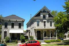
Champa Street at 27th in Denver | |
| Location | Roughly bounded by Arapahoe, 30th, California, and 24th Sts., Denver, Colorado |
|---|---|
| Area | 87 acres (35 ha) |
| Built | 1870 |
| Architectural style | Mixed (more Than 2 Styles From Different Periods) |
| NRHP Reference # | 75000507[1] |
| Added to NRHP | April 1, 1975 |
Curtis Champa Streets Historic District is located in Denver, Colorado. It was added to the National Register of Historic Places in 1975 and is bounded by Arapahoe, 30th, California, and 24th Sts. covering 870 acres and 356 buildings.[2] In 1983 the boundaries were expanded to roughly 30th, Stout, Downing and Arapahoe Sts., covering 870 acres and 77 buildings.[2]
See also
- National Register of Historic Places listings in downtown Denver, Colorado
- Auraria 9th Street Historic District
References
- ↑ National Park Service (2010-07-09). "National Register Information System". National Register of Historic Places. National Park Service.
- 1 2 NRHP listing
- ↑ Bill West; Barbara Norgren; Robert Carper (1975). "National Register of Historic Places Inventory/Nomination: Curtis Champa Streets Historic District" (PDF). National Park Service. and accompanying photos
| Topics | |
|---|---|
| Lists by states |
|
| Lists by insular areas | |
| Lists by associated states | |
| Other areas | |
| |
This article is issued from Wikipedia - version of the 10/9/2016. The text is available under the Creative Commons Attribution/Share Alike but additional terms may apply for the media files.