Dōzan River
Coordinates: 33°55′42.26″N 133°31′25.6″E / 33.9284056°N 133.523778°E
| Dōzan River 銅山川 | |
|---|---|
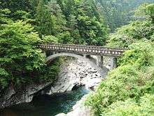 | |
| Country | Japan |
| Basin | |
| Main source |
Mount Kanmuri 1,732 m (5,682 ft) |
| River mouth | Yoshino River |
| Basin size | 280 km2 (110 sq mi) |
| Physical characteristics | |
| Length | 55 km (34 mi) |
| Discharge |
|
The Dōzan River (銅山川 Dōzan-gawa) is the largest branch of the Yoshino River and flows through Ehime and Tokushima prefectures in Japan.[1] Its name was derived from the Besshi copper mine that is now closed. In Tokushima Prefecture, it is called the Iyo River (伊予川 Iyo-gawa).[2]
Geography
The rivers originates Mount Kanmuri on the borders of Ehime and Kōchi prefectures. It then flows through Shikokuchūō in Ehime Prefecture and Miyoshi in Tokushima Prefecture, before joining with the Yoshino River.
History
In 1900, poisons from the various minerals excavated at the nearby copper mine seeped into the river, poisoning the local populations downstream.
References
This article is issued from Wikipedia - version of the 5/16/2016. The text is available under the Creative Commons Attribution/Share Alike but additional terms may apply for the media files.