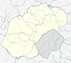
Dealesville
| Dealesville | |
|---|---|
 Dealesville  Dealesville  Dealesville
| |
| Coordinates: 28°40′S 25°46′E / 28.667°S 25.767°ECoordinates: 28°40′S 25°46′E / 28.667°S 25.767°E | |
| Country | South Africa |
| Province | Free State |
| District | Lejweleputswa |
| Municipality | Tokologo |
| Area[1] | |
| • Total | 29.31 km2 (11.32 sq mi) |
| Population (2011)[1] | |
| • Total | 5,446 |
| • Density | 190/km2 (480/sq mi) |
| Racial makeup (2011)[1] | |
| • Black African | 89.4% |
| • Coloured | 1.3% |
| • Indian/Asian | 1.8% |
| • White | 7.3% |
| • Other | 0.3% |
| First languages (2011)[1] | |
| • Tswana | 56.9% |
| • Xhosa | 19.4% |
| • Sotho | 10.2% |
| • Afrikaans | 9.0% |
| • Other | 4.5% |
| Postal code (street) | 9348 |
| PO box | 9348 |
| Area code | 051 |
Dealesville is a mixed farming town in the Free State province of South Africa and is surrounded by numerous salt pans. There are many natural springs in the vicinity, most notably Florisbad some 35 km from the town.
The town was established on the farm Klipfontein (Afrikaans for Stone fountain), which was owned by John Henry Deale.[2]
Town some 70 km north-west of Bloemfontein, 55 km south-east of Boshof and 111 km north-east of Kimberley. It was laid out on the farm Klipfontein and named after the owner, John Henry Deale. It was proclaimed a township in 1899 and achieved municipal status in 1914. The spas Baden-Baden and Florisbad are respectively 14 and 37 km from Dealesville.[3]
References
- 1 2 3 4 "Main Place Dealesville". Census 2011.
- ↑ Routes.co.za
- ↑ "Dictionary of Southern African Place Names (Public Domain)". Human Science Research Council. p. 131.
Geographic Location
 |
Hertzogville Bultfontein | Theunissen |  | |
| Kimberley Boshof | |
Brandfort | ||
| ||||
| | ||||
| Koffiefontein | Bloemfontein |
This article is issued from Wikipedia - version of the 8/18/2016. The text is available under the Creative Commons Attribution/Share Alike but additional terms may apply for the media files.
.svg.png)