Derradd
| Derradd | |
|---|---|
| Townland | |
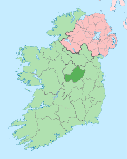
 Derradd Location of Derradd within County Westmeath in the Republic of Ireland | |
| Coordinates: 53°39′27″N 7°26′37″W / 53.65750°N 7.44361°WCoordinates: 53°39′27″N 7°26′37″W / 53.65750°N 7.44361°W | |
| Country |
|
| Province | Leinster |
| County | County Westmeath |
| Irish grid reference | N368676 |
Derradd is a townland in County Westmeath, Ireland. It is located about 16.13 kilometres (10 mi) north–north–west of Mullingar.
Derradd is one of 35 townlands of the civil parish of Street in the barony of Moygoish in the Province of Leinster. The townland covers 284.61 acres (1.1518 km2) and the eastern boundary is formed by the River Inny.
The neighbouring townlands are: Clonkeen to the north and west, Lackanwood to the south–east and Hospitalbank and Monagead to the south.[1][2]
A railway line carrying the national rail company Iarnród Éireann's Dublin to Longford commuter service and Dublin to Sligo intercity service[3] passes through the townland. The Ordnance Survey map, produced at the time of the Griffith's Valuation survey of Ireland (completed in 1869), shows a junction of two lines. The modern-day mainline is shown as the Mullingar and Longford Railway, the branch line to Cavan is marked as the Cavan Junction Railway and the station is shown as Cavan or Derradd Junction.[4]
In the 1911 census of Ireland there were 5 houses[5] and 33 inhabitants[6] in the townland. Six of the residents were railway employees.
References
- ↑ Derradd Townland, Co. Westmeath Townlands.ie Retrieved on 12 September 2015.
- ↑ Derradd Townland, Co. Westmeath The IreAtlas Townland Data Base Retrieved on 12 September 2015.
- ↑ Irish Rail Printable Timetables irishrail.ie Retrieved 12 September 2015
- ↑ Link to historic map of Derradd Townlands.ie Retrieved on 12 September 2015.
- ↑ Houses in Derradd. Census of Ireland 1911. Retrieved on 12 September 2015.
- ↑ Inhabitants in Derradd. Census of Ireland 1911. Retrieved on 12 September 2015.
External links
- Map of Derradd at openstreetmap.org
- Derradd at the IreAtlas Townland Data Base
- Derradd at Townlands.ie
- Derradd at The Placenames Database of Ireland, Department of Arts, Heritage and the Gaeltacht