Desteldonk
| Desteldonk | |
|---|---|
| Deelgemeente | |
|
Church of Our Lady from the 14th century | |
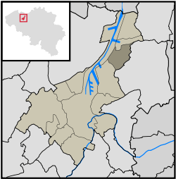 Desteldonk within Ghent | |
| Coordinates: 51°7′19″N 3°46′52″E / 51.12194°N 3.78111°E | |
| Country | Belgium |
| Province |
|
| Municipality | Ghent |
| Area | |
| • Total | 5.71 km2 (2.20 sq mi) |
| Population (31 December 2007) | |
| • Total | 897 |
| • Density | 157/km2 (410/sq mi) |
| Postal code | 9042 |

Desteldonk is a parish in the municipality of Ghent in the Belgian province of East Flanders. The first historical record of Desteldonk dates back to 967. The area has a population of 900. It became part of Ghent in 1965.
External links
![]() Media related to Desteldonk at Wikimedia Commons
Media related to Desteldonk at Wikimedia Commons
Coordinates: 51°07′17″N 3°46′53″E / 51.12139°N 3.78139°E
This article is issued from Wikipedia - version of the 1/5/2016. The text is available under the Creative Commons Attribution/Share Alike but additional terms may apply for the media files.