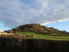
Dinedor Hill
| Dinedor Hill | |
|---|---|
 Dinedor Camp | |
| Highest point | |
| Elevation | 182.88 m (600.0 ft) |
| Coordinates | 52°01′25″N 2°41′47″W / 52.0235°N 2.6963°WCoordinates: 52°01′25″N 2°41′47″W / 52.0235°N 2.6963°W |
| Geography | |
| Location | Herefordshire, England |
| OS grid | SO522363 |
| Topo map | OS Landranger 149 |
Dinedor Hill is situated 2.5 miles south of Hereford. It is the site of Dinedor Camp, an Iron Age hillfort.
Further reading
- Children, G; Nash, G (1994) Prehistoric Sites of Herefordshire Logaston Press ISBN 1-873827-09-1
External links
This article is issued from Wikipedia - version of the 8/13/2012. The text is available under the Creative Commons Attribution/Share Alike but additional terms may apply for the media files.