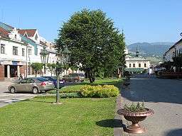
Dolný Kubín
| Dolný Kubín | ||
| Town | ||
 | ||
|
||
| Country | Slovakia | |
|---|---|---|
| Region | Žilina | |
| District | Dolný Kubín | |
| Parts | Orava | |
| River | Orava | |
| Elevation | 468 m (1,535 ft) | |
| Coordinates | SK 49°12′38″N 19°17′51″E / 49.21056°N 19.29750°ECoordinates: SK 49°12′38″N 19°17′51″E / 49.21056°N 19.29750°E | |
| Area | 55.055 km2 (21.257 sq mi) | |
| Population | 19,775 (31 December 2006) | |
| Density | 359/km2 (930/sq mi) | |
| First mentioned | 1325 | |
| Mayor | Roman Matejov | |
| Timezone | CET (UTC+1) | |
| - summer (DST) | CEST (UTC+2) | |
| Postal code | 026 01 | |
| Area code | +421-43 | |
| Car plate | DK | |
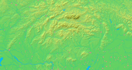  Location in Slovakia
| ||
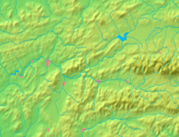  Location in the Žilina Region
| ||
| Wikimedia Commons: Dolný Kubín | ||
| Statistics: MOŠ/MIS | ||
| Website: www.dolnykubin.sk | ||
Dolný Kubín (![]() pronunciation ; also known by other names) is a town in northern Slovakia in the Žilina Region. It is the historical capital of the Orava region.
pronunciation ; also known by other names) is a town in northern Slovakia in the Žilina Region. It is the historical capital of the Orava region.
Names
The name is derived from the archaic Slovak word "klubin" meaning "a glade covered by smoke after burnt roots".[1] "Dolný Kubín" means Lower Kubín, in contrast with to Vyšný (Upper) Kubín. The location and the settlement was known also as Kublen (1314), Clbin (1393), Culbyn (1408), Kubyn Nysny (1547), Dolny Kubin (1773). Other names in the past include German: Unterkubin and Hungarian: Alsókubin.
Geography
Dolný Kubín lies at an altitude of 468 metres (1,535 ft) above sea level and covers an area of 55.055 square kilometres (21.3 sq mi).[2] It is located in northern Slovakia on the Orava River, between the Lesser Fatra, Oravská Magura and Chočské vrchy mountains. It is located around 15 km (9.32 mi) from Ružomberok, 45 km (27.96 mi) from the Polish border and 270 km (167.77 mi) from Bratislava. The town is composed of 10 boroughs: Banisko, Beňova Lehota, Brezovec, Kňažia, Malý Bysterec, Medzihradné, Mokraď, Staré mesto, Veľký Bysterec and Záskalie.
Climate
The Köppen Climate Classification subtype for this climate is "Dfb" (Warm Summer Continental Climate).[3]
History
The first written reference of the location dates from 1314 and is about the land (not the settlement yet) Kubín. In 1325, the existence of "Superior Kolbyn“ (Vyšný Kubín) was recorded what could indicate also the existence of Dolný Kubín, more detailed information about the settlement are from 1380s. The settlement belonged to the Orava Castle and was the center for the neighboring settlements. The citizens lived by animal husbandry and hunting, but also by quarrying.[5] It was granted town privileges (town status, town charter) in 1632, and its importance was further strengthened in 1633 when the town was granted the right to hold markets. In 1683 the town became the seat of the Orava county and in 1776 also the seat of a processus district. In the 19th century Dolný Kubín was a centre of Slovak national life and the poet Pavol Országh Hviezdoslav and other Slovak national revivalists were active in the town.
After World War I, Dolný Kubín remained the seat of the Orava County until 1923, when Orava became a part of Váh County and it became the seat of the district. During World War II, the local garrison actively participated in preparation of Slovak National Uprising. Between December 1944 and January 1945, the town suffered from retaliatory actions and mass arrests. Red Army arrived to the town in the night from 4 to 5 April 1945, warmly welcomed by the local population.[5]
The town experienced major developments mainly after World War II, when electrical works as well as other enterprises were established.
Landmarks and culture
The Gothic St. Catherine church was built in the 14th century. The Čaplovič Library, containing collection of newspapers, books, maps and other printed works from 15th to the 19th century, along with the P. O. Hviezdoslav Museum, is located in the town. The Orava Gallery focuses on the art works from the 15th century to the 20th century and is seated in the former County House from the 17th century.[6] The Slovak poetical and prose competition, called Hviezdoslavov Kubín (Hviezdoslav's Kubín), takes place in the town since 1954. The Orava Castle is located few kilometres north-east of the town.
Demographics
According to the 2001 census, the town had 19,948 inhabitants. 97.03% of inhabitants were Slovaks, 1.07% Czechs and 0.28% Roma.[2] The religious make-up was 65.11% Roman Catholics, 16.62% Lutherans and 14.55% people with no religious affiliation.[2]
Sport
- BK Dolný Kubín played the best basketball competition in Slovakia 2006/07-2008/09. To season 2009/10 season the club came because of the collapse.
- MFK Dolný Kubín promoted to the I. Liga in the second league season 2008/09. In second league captured first place and collected only 16 goals.
- MHK Dolný Kubín plays First League in Slovakia and it is holding MHC Martin
Twin towns — Sister cities
Dolný Kubín is twinned with:
-
 Braunau am Inn, Austria
 -
 Eger, Hungary
 -
 Kamianets-Podilskyi, Ukraine
 -
 Limanowa, Poland
 -
 Pelhřimov, Czech Republic
 -
 Svendborg, Denmark
 - Truskavets, Ukraine
- Zawiercie, Poland
- Żywiec, Poland
Personalities
- Pavol Országh Hviezdoslav (1849–1921), Slovak poet, born in nearby Vyšný Kubín, but lived and died in Dolný Kubín.
- Ladislav Nádaši-Jégé (1866–1940), Slovak author, born, lived and died in Dolný Kubín.
- Janko Matúška (1821–1877), author of Slovakia's national anthem, was born, became clerk of the district court, and died in Dolný Kubín.
- Juraj Laštík (b. 1987), Slovakian ski mountaineer
- Ján Johanides (1934–2008), Slovak writer
See also
References
- ↑ Krajčovič, Rudolf (2010). "Z lexiky stredovekej slovenčiny s výkladmi názvov obcí a miest (22)". Kultúra slova (in Slovak). Martin: Vydavateľstvo Matice slovenskej (4): 230. ISSN 0023-5202..
- 1 2 3 "Municipal Statistics". Statistical Office of the Slovak republic. Archived from the original on 2007-11-16. Retrieved 2007-12-12.
- ↑ Climate Summary
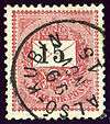
- ↑ Die Poststempel auf der Freimarken-Ausgabe 1867 von Österreich und Ungarn, Edwin Mueller, 1930, type G1.
- 1 2 Huba, Peter. "História mesta Dolný Kubín" (PDF) (in Slovak). Retrieved 15 October 2016.
- ↑ http://www.dolnykubin.sk/sk/navstevnik/o_meste/historia_mesta/ (Slovak)
Genealogical resources
The records for genealogical research are available at the state archive "Statny Archiv in Bytca, Slovakia"
- Roman Catholic church records (births/marriages/deaths): 1672-1898 (parish A)
- Lutheran church records (births/marriages/deaths): 1787-1897 (parish A)
External links
Municipalities of Dolný Kubín District | ||
|---|---|---|