Drong Hill

Location of Byers Peninsula on Livingston Island in the South Shetland Islands.
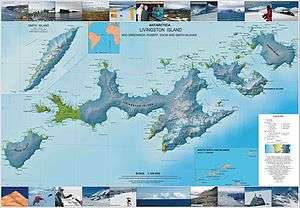
Topographic map of Livingston Island, Greenwich, Robert, Snow and Smith Islands.
Drong Hill (Bulgarian: хълм Дронг, ‘Halm Drong’ \'h&lm 'drong\) is the double rocky hill rising to 179 m in the northwest extremity of Dospey Heights on Byers Peninsula, Livingston Island in the South Shetland Islands, Antarctica. Situated 550 m east-southeast of Essex Point, 1.52 km west of Voyteh Point and 600 m northeast of Kardzhali Point.
The hill is named after the Bulgar ruler Drong (6th Century AD).
Location
Drong Hill is located at 62°34′44.7″S 61°10′29.6″W / 62.579083°S 61.174889°WCoordinates: 62°34′44.7″S 61°10′29.6″W / 62.579083°S 61.174889°W. Spanish mapping in 1992 and Bulgarian in 2009.
Maps
- Península Byers, Isla Livingston. Mapa topográfico a escala 1:25000. Madrid: Servicio Geográfico del Ejército, 1992.
- L.L. Ivanov. Antarctica: Livingston Island and Greenwich, Robert, Snow and Smith Islands. Scale 1:120000 topographic map. Troyan: Manfred Wörner Foundation, 2009. ISBN 978-954-92032-6-4
References
This article includes information from the Antarctic Place-names Commission of Bulgaria which is used with permission.
This article is issued from Wikipedia - version of the 11/21/2015. The text is available under the Creative Commons Attribution/Share Alike but additional terms may apply for the media files.