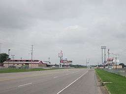
East Cape Girardeau, Illinois
| East Cape Girardeau | |
| Village | |
 | |
| Country | United States |
|---|---|
| State | Illinois |
| County | Alexander |
| Elevation | 335 ft (102 m) |
| Coordinates | 37°17′46″N 89°29′43″W / 37.29611°N 89.49528°WCoordinates: 37°17′46″N 89°29′43″W / 37.29611°N 89.49528°W |
| Area | 2.00 sq mi (5 km2) |
| - land | 1.96 sq mi (5 km2) |
| - water | 0.03 sq mi (0 km2) |
| Population | 385 (2010) |
| Density | 196.4/sq mi (76/km2) |
| Timezone | CST (UTC-6) |
| - summer (DST) | CDT (UTC-5) |
| Postal code | 62957 |
| Area code | 618 |
| FIPS code | 17-21605 |
| GNIS ID | 2398772 |
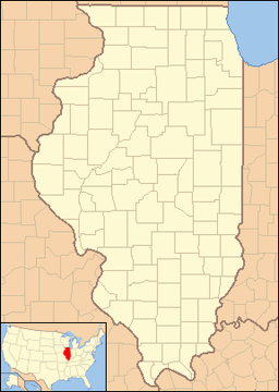 Location of East Cape Girardeau within Illinois
| |
| Wikimedia Commons: East Cape Girardeau, Illinois | |
East Cape Girardeau is a village in Alexander County, Illinois, United States. The population was 385 at the 2010 census.[1] It is part of the Cape Girardeau–Jackson, MO-IL Metropolitan Statistical Area.
History
A post office was established at East Cape Girardeau in 1874, and remained in operation until 1913.[2] The village lies east of Cape Girardeau, hence the name.[3]
Geography
East Cape Girardeau is located at 37°17′46″N 89°29′43″W / 37.29611°N 89.49528°W (37.296030, -89.495237).[4]
According to the 2010 census, East Cape Girardeau has a total area of 1.994 square miles (5.16 km2), of which 1.96 square miles (5.08 km2) (or 98.29%) is land and 0.034 square miles (0.09 km2) (or 1.71%) is water.[5]
East Cape Girardeau is across the Mississippi River from Cape Girardeau, Missouri. The two are connected by the Bill Emerson Memorial Bridge which opened in December 2003 following the demolition of the Old Mississippi River Bridge constructed in 1928.
Demographics
| Historical population | |||
|---|---|---|---|
| Census | Pop. | %± | |
| 1980 | 539 | — | |
| 1990 | 451 | −16.3% | |
| 2000 | 437 | −3.1% | |
| 2010 | 385 | −11.9% | |
| Est. 2015 | 331 | [6] | −14.0% |
As of the census[8] of 2000, there were 437 people, 196 households, and 130 families residing in the village. The population density was 222.0 people per square mile (85.6/km²). There were 235 housing units at an average density of 119.4 per square mile (46.1/km²). The racial makeup of the village was 97.25% White, 0.69% African American, 0.23% Asian, 1.14% from other races, and 0.69% from two or more races. Hispanic or Latino of any race were 2.29% of the population.
There were 196 households out of which 32.1% had children under the age of 18 living with them, 49.5% were married couples living together, 14.3% had a female householder with no husband present, and 33.2% were non-families. 30.1% of all households were made up of individuals and 12.8% had someone living alone who was 65 years of age or older. The average household size was 2.23 and the average family size was 2.72.
In the village the population was spread out with 22.7% under the age of 18, 8.2% from 18 to 24, 27.9% from 25 to 44, 25.6% from 45 to 64, and 15.6% who were 65 years of age or older. The median age was 39 years. For every 100 females there were 95.1 males. For every 100 females age 18 and over, there were 94.3 males.
The median income for a household in the village was $29,688, and the median income for a family was $33,897. Males had a median income of $31,932 versus $16,875 for females. The per capita income for the village was $14,420. About 10.9% of families and 10.5% of the population were below the poverty line, including 6.8% of those under age 18 and 9.1% of those age 65 or over.
References
- ↑ "Geographic Identifiers: 2010 Demographic Profile Data (G001): East Cape Girardeau village, Illinois". U.S. Census Bureau, American Factfinder. Retrieved May 8, 2013.
- ↑ "Alexander County". Jim Forte Postal History. Retrieved 4 November 2015.
- ↑ Callary, Edward (29 September 2008). Place Names of Illinois. University of Illinois Press. p. 103. ISBN 978-0-252-09070-7.
- ↑ "US Gazetteer files: 2010, 2000, and 1990". United States Census Bureau. 2011-02-12. Retrieved 2011-04-23.
- ↑ "G001 - Geographic Identifiers - 2010 Census Summary File 1". United States Census Bureau. Retrieved 2015-08-03.
- ↑ "Annual Estimates of the Resident Population for Incorporated Places: April 1, 2010 to July 1, 2015". Retrieved July 2, 2016.
- ↑ "Census of Population and Housing". Census.gov. Retrieved June 4, 2015.
- ↑ "American FactFinder". United States Census Bureau. Retrieved 2008-01-31.
Municipalities and communities of Alexander County, Illinois, United States | ||
|---|---|---|
| City | ||
| Villages | ||
| Precincts | ||
| CDP | ||
| Unincorporated communities | ||
| Ghost town | ||