East Carleton
For the similarly named village in Northamptonshire, see East Carlton.
| East Carleton | |
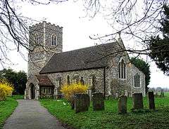 St Mary, East Carleton |
|
 East Carleton |
|
| Area | 4.96 km2 (1.92 sq mi) |
|---|---|
| Population | 343 |
| – density | 69/km2 (180/sq mi) |
| OS grid reference | TG176020 |
| Civil parish | East Carleton |
| District | South Norfolk |
| Shire county | Norfolk |
| Region | East |
| Country | England |
| Sovereign state | United Kingdom |
| Post town | NORWICH |
| Postcode district | NR14 |
| Police | Norfolk |
| Fire | Norfolk |
| Ambulance | East of England |
| EU Parliament | East of England |
Coordinates: 52°34′23″N 1°12′36″E / 52.573°N 1.210°E
East Carleton is a civil parish in the English county of Norfolk. It covers an area of 4.96 km2 (1.92 sq mi) and had a population of 358 in 115 households at the 2001 census,[1] the population falling to 343 at the 2011 census.[2] For the purposes of local government, it falls within the district of South Norfolk.
Notes
- ↑ "East Carleton parish information". South Norfolk Council. 29 March 2007. Retrieved 20 June 2009.
- ↑ "Civil Parish population 2011". Retrieved 8 September 2015.
External links
![]() Media related to East Carleton at Wikimedia Commons
Media related to East Carleton at Wikimedia Commons
This article is issued from Wikipedia - version of the 9/8/2015. The text is available under the Creative Commons Attribution/Share Alike but additional terms may apply for the media files.