East Warburton Basin
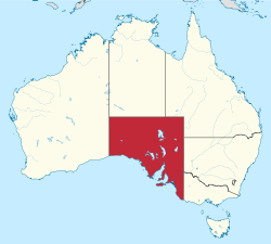
The state of South Australia. Warburton Basin would be at the NE corner.
The East Warburton Basin in South Australia is the site of a large impact crater of the Carboniferous period (around 360-300 million years ago). The subterranean structure lies buried at a depth of ~4 km, and measures a minimum of 200 km in diameter.[1] For comparison, Chicxulub crater is about 180 km in diameter.
Scientists identified the impact formation through analysis of shocked quartz grains from the area after a circular anomaly appeared in seismic tomography studies of the region.[2]
See also
Coordinates: 28°00′S 140°30′E / 28°S 140.5°E
References
- ↑ Vast asteroid impact zone found in Australia AFP/Google News, 19 February 2013. Accessed 15 May 2013.
- ↑ Geophysical anomalies and quartz microstructures, Eastern Warburton Basin, North-east South Australia: Tectonic or impact shock metamorphic origin? Tectonophysics Vol. 589, 18 March 2013, Pp. 57–76. Accessed 15 May 2013.
This article is issued from Wikipedia - version of the 6/13/2016. The text is available under the Creative Commons Attribution/Share Alike but additional terms may apply for the media files.